MyTopo
Wood Lake Minnesota US Topo Map
Couldn't load pickup availability
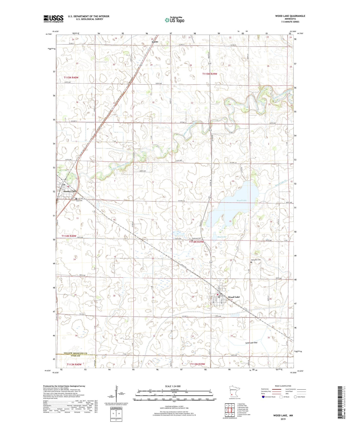
2022 topographic map quadrangle Wood Lake in the state of Minnesota. Scale: 1:24000. Based on the newly updated USGS 7.5' US Topo map series, this map is in the following counties: Yellow Medicine, Lyon. The map contains contour data, water features, and other items you are used to seeing on USGS maps, but also has updated roads and other features. This is the next generation of topographic maps. Printed on high-quality waterproof paper with UV fade-resistant inks.
Quads adjacent to this one:
West: Wood Lake NW
Northwest: Hazel Run
North: Granite Falls
Northeast: Minnesota Falls
East: Lone Tree Lake
Southeast: Echo
South: School Grove Lake
Southwest: Cottonwood
This map covers the same area as the classic USGS quad with code o44095f5.
Contains the following named places: City of Hanley Falls, City of Wood Lake, County Ditch Number Fortynine, County Ditch Number Fortyone, County Ditch Number Fourteen, County Ditch Number Thirtyone, East Cemetery, Hanley Falls, Hanley Falls Post Office, Hanley Falls Volunteer Fire Department, Judicial Ditch Number Ten, Lakeview Middle School, Lorne, Lorne Post Office, Lutheran Cemetery, Methodist Cemetery, Minnesota's Machinery Museum, Mud Lake, Saint John's Lutheran Church, Sand Lake Bed, Township of Wood Lake, United Methodist Church, Wood Lake, Wood Lake Fire Department, Wood Lake Post Office, Yellow Medicine Lutheran Church, ZIP Code: 56297