MyTopo
Zerkel Minnesota US Topo Map
Couldn't load pickup availability
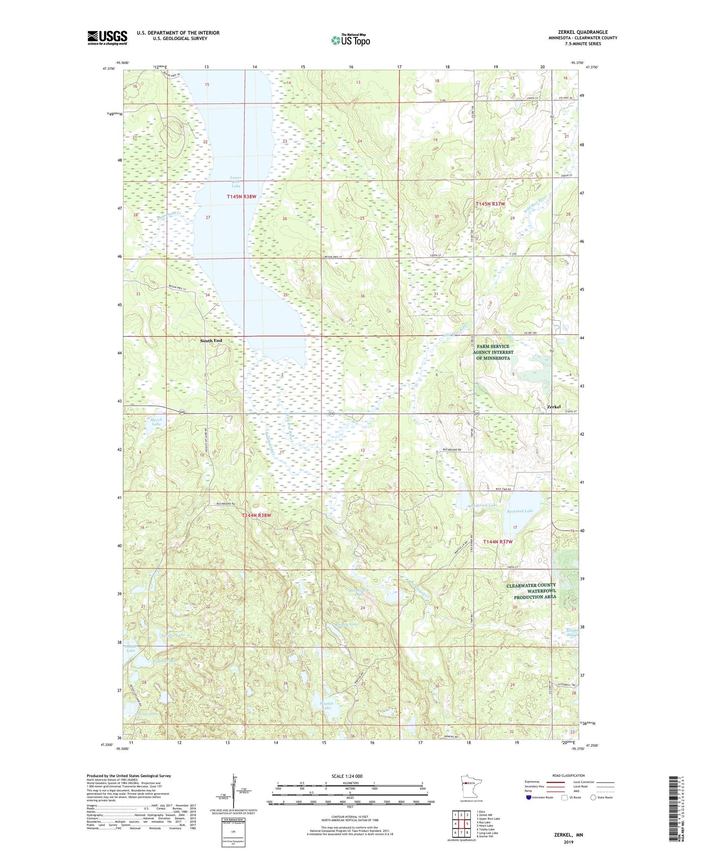
2022 topographic map quadrangle Zerkel in the state of Minnesota. Scale: 1:24000. Based on the newly updated USGS 7.5' US Topo map series, this map is in the following counties: Clearwater. The map contains contour data, water features, and other items you are used to seeing on USGS maps, but also has updated roads and other features. This is the next generation of topographic maps. Printed on high-quality waterproof paper with UV fade-resistant inks.
Quads adjacent to this one:
West: Roy Lake
Northwest: Ebro
North: Zerkel NW
Northeast: Upper Rice Lake
East: Heart Lake
Southeast: Anchor Hill
South: Long Lost Lake
Southwest: Tulaby Lake
This map covers the same area as the classic USGS quad with code o47095c4.
Contains the following named places: Anderson Lake, Auganaush Creek, Big Bear Landing, Blakely Lake, Bonga Landing, Buckboard Creek, Buckboard Lake, Bush Landing, Hier Creek, Island Lake, Lower Rice Lake, Lower Rice Lake State Wildlife Management Ar, March Lake, Minerva, Ponsford Landing, Rockstad Lake, South End Census Designated Place, Sugarbush Lookout Tower, Teapail Lake, Tincup Lake, Township of La Prairie, Wapatus Lake, Waptus Lake, Zerkel, Zerkel Post Office