MyTopo
Lower Whitefish Lake Minnesota US Topo Map
Couldn't load pickup availability
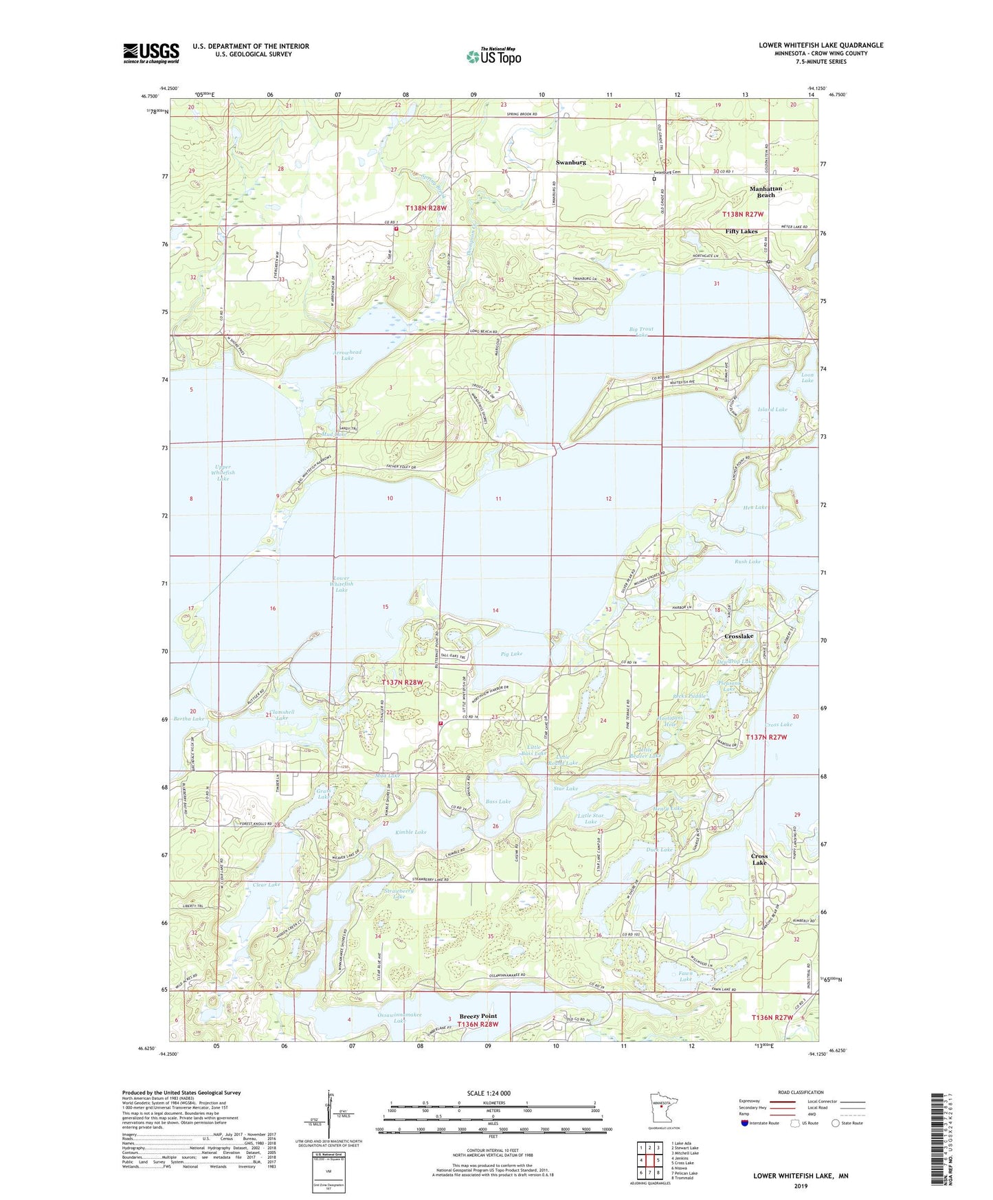
2019 topographic map quadrangle Lower Whitefish Lake in the state of Minnesota. Scale: 1:24000. Based on the newly updated USGS 7.5' US Topo map series, this map is in the following counties: Crow Wing. The map contains contour data, water features, and other items you are used to seeing on USGS maps, but also has updated roads and other features. This is the next generation of topographic maps. Printed on high-quality waterproof paper with UV fade-resistant inks.
Quads adjacent to this one:
West: Jenkins
Northwest: Lake Ada
North: Stewart Lake
Northeast: Mitchell Lake
East: Cross Lake
Southeast: Trommald
South: Pelican Lake
Southwest: Nisswa
Contains the following named places: Arrowhead Lake, Bass Lake, Big Trout Lake, City of Manhattan Beach, Clamshell Lake, Clear Lake, Cross Lake, Dewdrop Lake, Duck Lake, Faith Lutheran Church, Fawn Lake, Golden Harbor Mobile Home Park, Grass Lake, Hen Lake, Henry Lake, Highview Campground, Hooligans Hole, Ideal Corners, Ideal Township Fire Department Station 1, Ideal Township Fire Department Station 2, Island Lake, Kimble Lake, Lakewood Court, Little Bass Lake, Little Beaver Lake, Little Round Lake, Little Star Lake, Loon Lake, Lower Whitefish Lake, Manhattan Beach, Manhattan Beach Post Office, Mud Lake, Ossawinnamakee Lake, Ossawinnamakee Lake Dam, Our Lady of the Snows Chapel, Pecks Puddle, Pig Lake, Pleasant Lake, Richard Perkins Dam, Rush Lake, Spring Brook, Star Lake, Strawberry Lake, Sunset Bay Trailer Park, Swanburg, Swanburg Cemetery, Swanburg Post Office, Thompson Creek, Township of Ideal, Whitefish Golf Course