MyTopo
Stewart Lake Minnesota US Topo Map
Couldn't load pickup availability
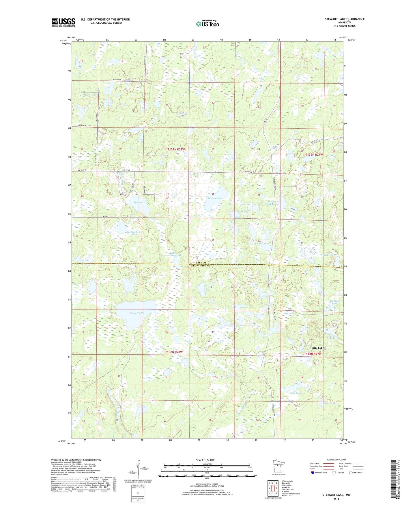
2022 topographic map quadrangle Stewart Lake in the state of Minnesota. Scale: 1:24000. Based on the newly updated USGS 7.5' US Topo map series, this map is in the following counties: Cass, Crow Wing. The map contains contour data, water features, and other items you are used to seeing on USGS maps, but also has updated roads and other features. This is the next generation of topographic maps. Printed on high-quality waterproof paper with UV fade-resistant inks.
Quads adjacent to this one:
West: Lake Ada
Northwest: Woman Lake
North: Longville
Northeast: Laura Lake
East: Mitchell Lake
Southeast: Cross Lake
South: Lower Whitefish Lake
Southwest: Jenkins
This map covers the same area as the classic USGS quad with code o46094g2.
Contains the following named places: Big Cranberry Lake, Big Stone Lake, Blind Lake, Blind Lake Church, Blue Lake, Boiler Lake, Clear Lake, Corral Lake, Dirty House Lake, Island Lake, Lee Lake, Lily Lake, Little Cranberry Lake, Lone Pine Lake, Peterson Lake, Stewart Lake, Stony Lake, Township of Blind Lake, Township of Timothy