MyTopo
Lake Ada Minnesota US Topo Map
Couldn't load pickup availability
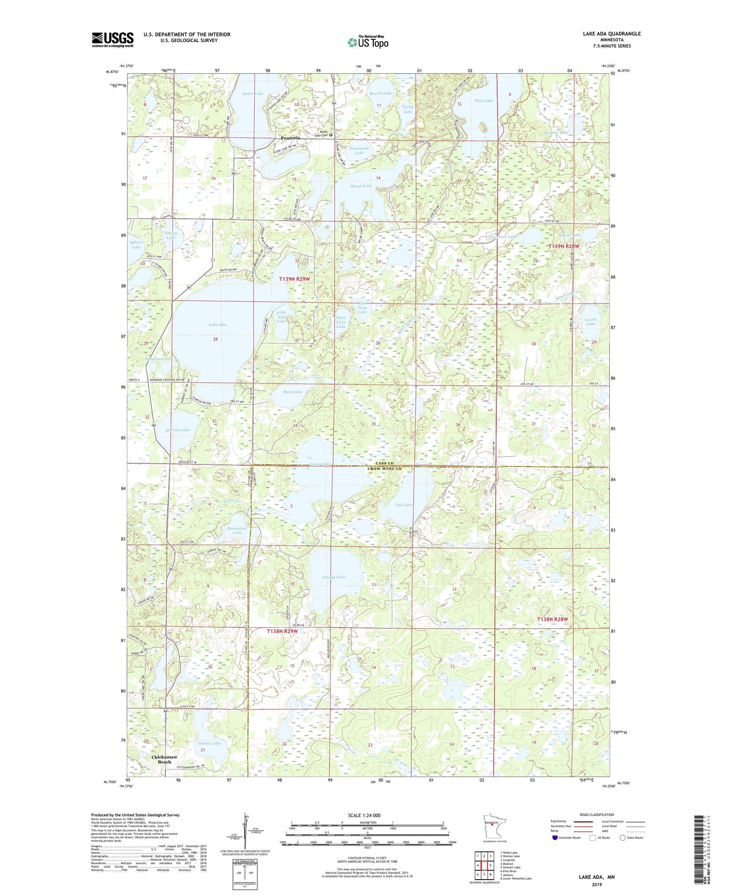
2022 topographic map quadrangle Lake Ada in the state of Minnesota. Scale: 1:24000. Based on the newly updated USGS 7.5' US Topo map series, this map is in the following counties: Cass, Crow Wing. The map contains contour data, water features, and other items you are used to seeing on USGS maps, but also has updated roads and other features. This is the next generation of topographic maps. Printed on high-quality waterproof paper with UV fade-resistant inks.
Quads adjacent to this one:
West: Mildred
Northwest: Webb Lake
North: Woman Lake
Northeast: Longville
East: Stewart Lake
Southeast: Lower Whitefish Lake
South: Jenkins
Southwest: Pine River
This map covers the same area as the classic USGS quad with code o46094g3.
Contains the following named places: Bass Lake, Blind Lake Creek, Clough Lake, Deadman Lake, East Twin Lake, Hand Lake, Harriet Lake, Hay Lake, Horseshoe Lake, Jail Lake, Lake Ada, Little Ada Lake, Lizotte Lake, Lizzie Lake, Louise Lake, Ponto Lake, Ponto Lake Cemetery, Pontoria, Pontoria Post Office, Potshot Lake, Round Lake, Sand Lake Number One, Sand Lake Number Two, Smiley Lake, Stony Lake, Swede Lake, Tamarack Lake, Township of Barclay, Township of Gail Lake, Township of Ponto Lake, West Twin Lake