MyTopo
Madison Minnesota US Topo Map
Couldn't load pickup availability
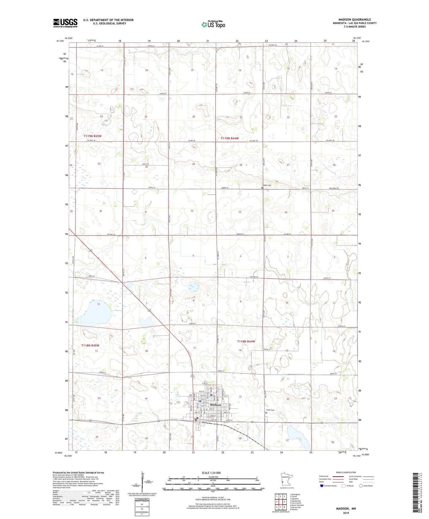
2019 topographic map quadrangle Madison in the state of Minnesota. Scale: 1:24000. Based on the newly updated USGS 7.5' US Topo map series, this map is in the following counties: Lac qui Parle. The map contains contour data, water features, and other items you are used to seeing on USGS maps, but also has updated roads and other features. This is the next generation of topographic maps. Printed on high-quality waterproof paper with UV fade-resistant inks.
Quads adjacent to this one:
West: Haydenville
Northwest: Bellingham
North: Correll
Northeast: Appleton
East: Cerro Gordo
Southeast: Dawson
South: Dawson NW
Southwest: Mount Wickham
Contains the following named places: Calvary Baptist Church, Circle B Elder Care Center, City of Madison, Congregational Church, Faith Cemetery, Faith Lutheran Church, Hegre Cemetery, KLQP-FM (Madison), Lac qui Parle Clinic at Madison, Lac qui Parle County Courthouse, Lac qui Parle County Fairgrounds, Lac qui Parle County Jail, Lac qui Parle County Museum, Lac qui Parle County Sheriff's Office, Lac qui Parle Sheriff Office, Lacquiparle High School, Madison, Madison Ambulance Service, Madison City Hall, Madison Country Club, Madison Elementary School, Madison Fire Department, Madison Fire Hall, Madison Hospital, Madison Lutheran Home, Madison Police Department, Madison Post Office, Madison Public Library, Saint John's Lutheran Church, Saint Michael's Church, Township of Madison, United Church of Christ, United Methodist Church, ZIP Code: 56256