MyTopo
Mahnomen Minnesota US Topo Map
Couldn't load pickup availability
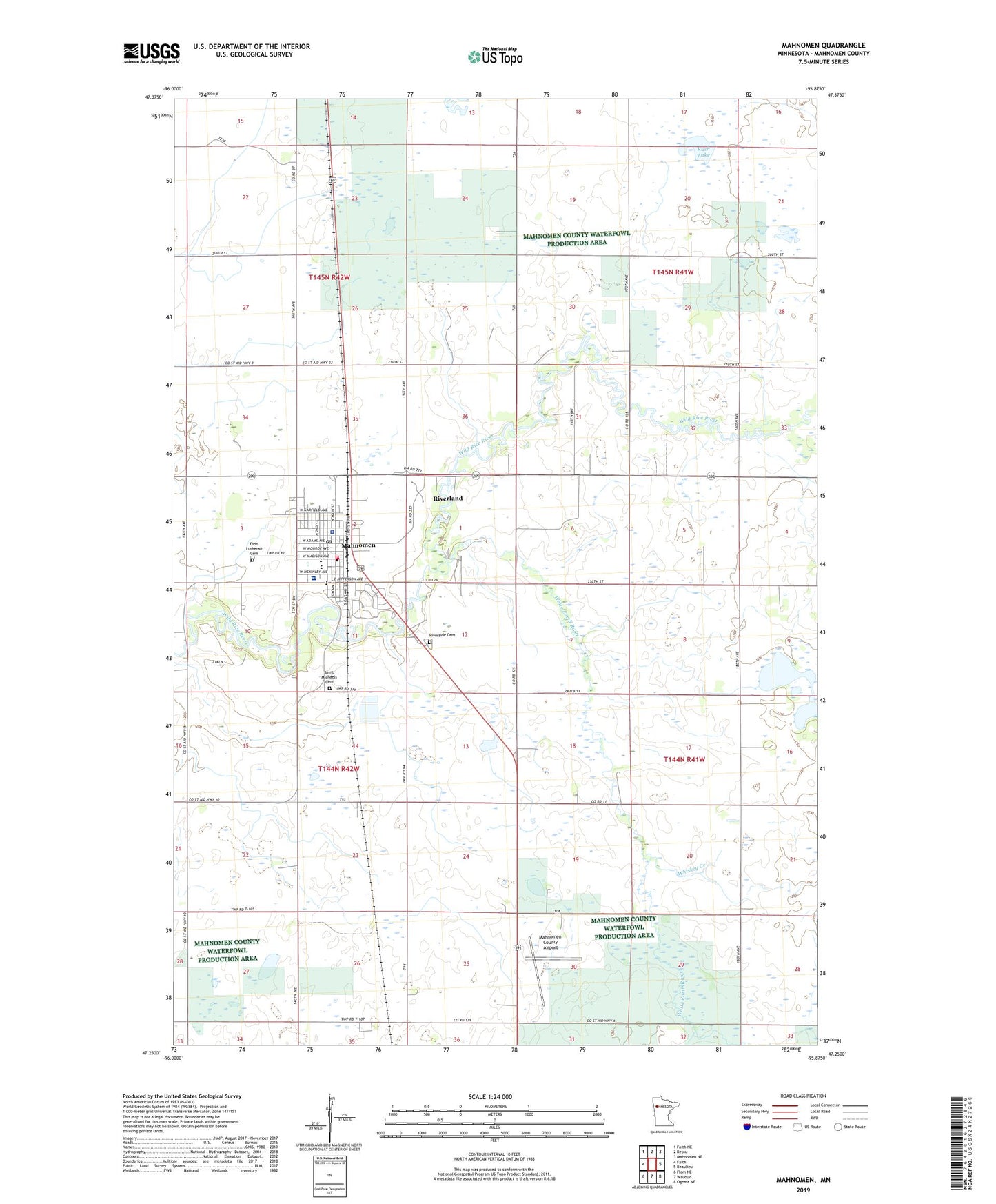
2022 topographic map quadrangle Mahnomen in the state of Minnesota. Scale: 1:24000. Based on the newly updated USGS 7.5' US Topo map series, this map is in the following counties: Mahnomen. The map contains contour data, water features, and other items you are used to seeing on USGS maps, but also has updated roads and other features. This is the next generation of topographic maps. Printed on high-quality waterproof paper with UV fade-resistant inks.
Quads adjacent to this one:
West: Faith
Northwest: Faith NE
North: Bejou
Northeast: Mahnomen NE
East: Beaulieu
Southeast: Ogema NE
South: Waubun
Southwest: Flom NE
This map covers the same area as the classic USGS quad with code o47095c8.
Contains the following named places: Assembly of God Church, Bethlehem Lutheran Church, City of Mahnomen, First Lutheran Cemetery, First Lutheran Church, Gardner Lake, Mahnomen, Mahnomen City Hall, Mahnomen County Airport, Mahnomen County and Village Hospital Heliport, Mahnomen County Country Club, Mahnomen County Courthouse, Mahnomen County Jail, Mahnomen County Sheriff's Office, Mahnomen Health Center, Mahnomen Health Center Ambulance, Mahnomen High School, Mahnomen Mobile Home Park, Mahnomen Post Office, Mahnomen Public Library, Mahnomen Volunteer Fire Department, Meritcare Mahnomen Clinic, Nee Gon Nee Lutheran Church, Riverland Census Designated Place, Riverside Cemetery, Rush Lake, Rush Lake State Wildlife Management Area, Saint Michael's Catholic Church, Saint Michaels Cemetery, Saint Michael's School, Whiskey Creek, White Earth River