MyTopo
Bejou Minnesota US Topo Map
Couldn't load pickup availability
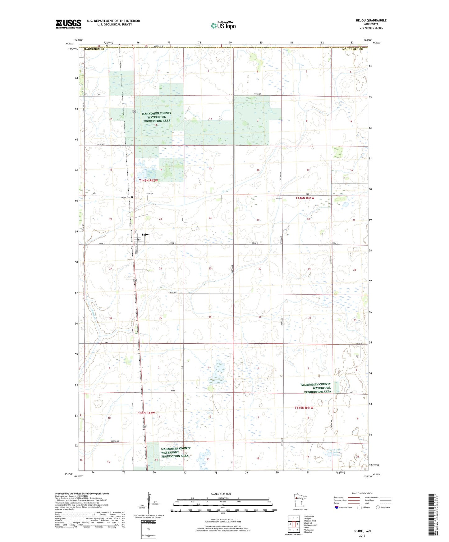
2022 topographic map quadrangle Bejou in the state of Minnesota. Scale: 1:24000. Based on the newly updated USGS 7.5' US Topo map series, this map is in the following counties: Mahnomen, Polk. The map contains contour data, water features, and other items you are used to seeing on USGS maps, but also has updated roads and other features. This is the next generation of topographic maps. Printed on high-quality waterproof paper with UV fade-resistant inks.
Quads adjacent to this one:
West: Faith NE
Northwest: Union Lake
North: Winger
Northeast: Fosston West
East: Mahnomen NE
Southeast: Beaulieu
South: Mahnomen
Southwest: Faith
This map covers the same area as the classic USGS quad with code o47095d8.
Contains the following named places: Bejou, Bejou Cemetery, Bejou Post Office, Church Lake, City of Bejou, Gregory State Wildlife Management Area, Immanuel Lutheran Church, Judicial Ditch Number Ninetyone, Loncrace State Wildlife Management Area, Mahgre State Wildlife Management Area, Twin Oaks Lake, Wambach State Wildlife Management Area, ZIP Code: 56516