MyTopo
Mazeppa Minnesota US Topo Map
Couldn't load pickup availability
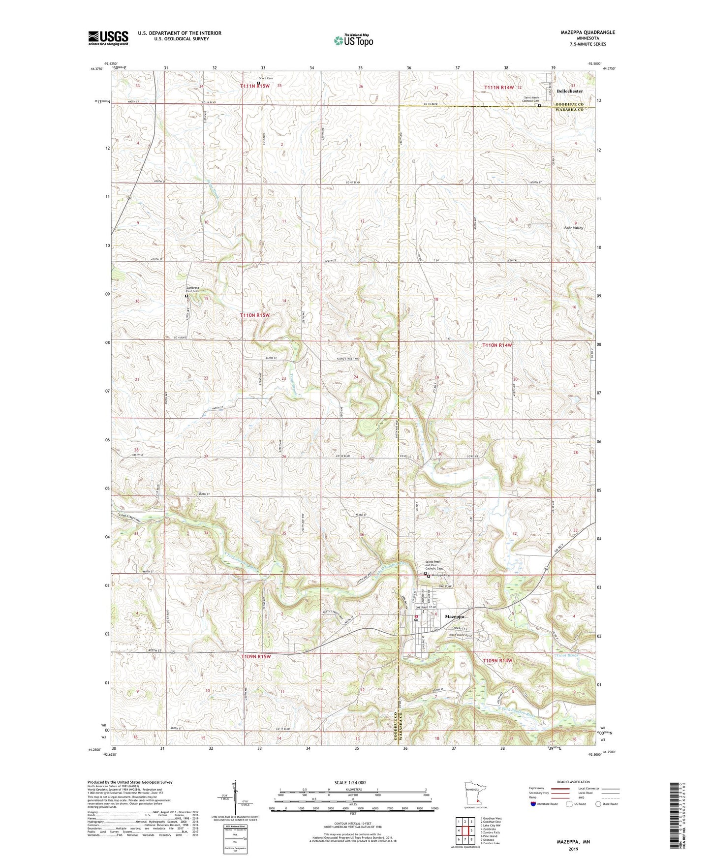
2019 topographic map quadrangle Mazeppa in the state of Minnesota. Scale: 1:24000. Based on the newly updated USGS 7.5' US Topo map series, this map is in the following counties: Goodhue, Wabasha. The map contains contour data, water features, and other items you are used to seeing on USGS maps, but also has updated roads and other features. This is the next generation of topographic maps. Printed on high-quality waterproof paper with UV fade-resistant inks.
Quads adjacent to this one:
West: Zumbrota
Northwest: Goodhue West
North: Goodhue East
Northeast: Lake City NW
East: Zumbro Falls
Southeast: Zumbro Lake
South: Oronoco
Southwest: Pine Island
Contains the following named places: Apple Ridge Orchard, Bellechester, Bellechester Post Office, City of Bellechester, City of Mazeppa, Grace Church, Grace Luthern Church Cemetery, Mazeppa, Mazeppa Cemetery, Mazeppa Fire and Rescue, Mazeppa Post Office, Mazeppa School, Merlyn Hadler, Merlyn Hadler Detention Dam, Pahl View Farm, Saint John's Lutheran Church, Saint Mary's Catholic Cemetery, Saint Peter and Paul Catholic Church, Saints Peter and Paul Catholic Cemetery, Structure S-21B Dam, Structure S-22B Dam, Township of Zumbrota, Zumbro River Dam, Zumbro River Reservoir, Zumbrota East Cemetery, ZIP Code: 55956