
MyTopo
Mount Weber Minnesota US Topo Map
Couldn't load pickup availability
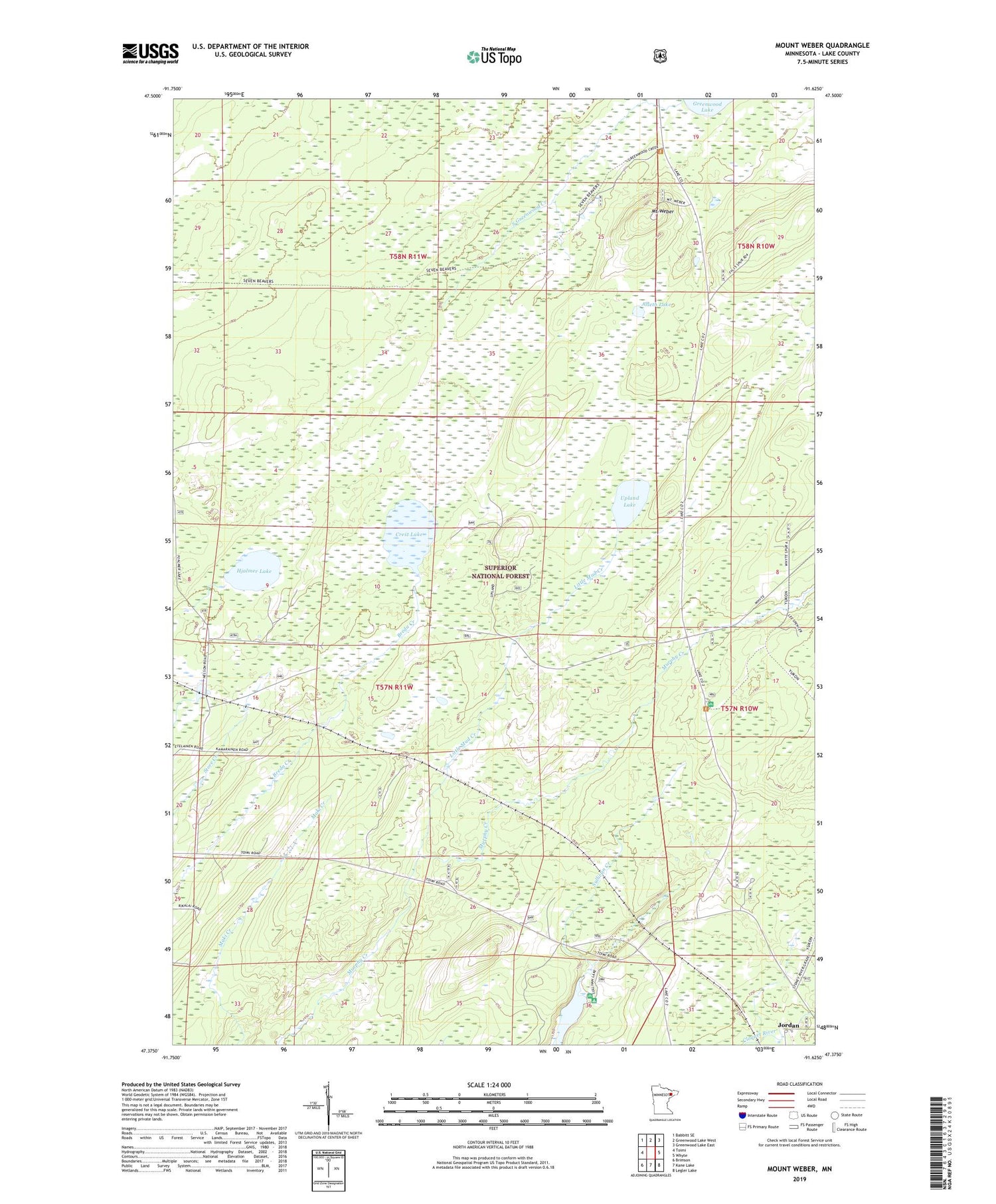
2019 topographic map quadrangle Mount Weber in the state of Minnesota. Scale: 1:24000. Based on the newly updated USGS 7.5' US Topo map series, this map is in the following counties: Lake. The map contains contour data, water features, and other items you are used to seeing on USGS maps, but also has updated roads and other features. This is the next generation of topographic maps. Printed on high-quality waterproof paper with UV fade-resistant inks.
Quads adjacent to this one:
West: Toimi
Northwest: Babbitt SE
North: Greenwood Lake West
Northeast: Greenwood Lake East
East: Whyte
Southeast: Legler Lake
South: Kane Lake
Southwest: Brimson
Contains the following named places: Alseth Lake, Crest Lake, Hjalmer Lake, Jordan, Little Mud Creek, Mount Weber, South Greenwood Creek, Sullivan Lake, Upland Lake, White Pine Picnic Area


