MyTopo
New Auburn Minnesota US Topo Map
Couldn't load pickup availability
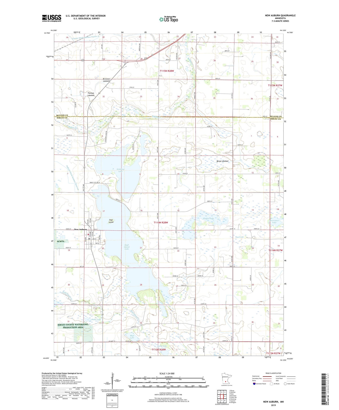
2019 topographic map quadrangle New Auburn in the state of Minnesota. Scale: 1:24000. Based on the newly updated USGS 7.5' US Topo map series, this map is in the following counties: Sibley, McLeod. The map contains contour data, water features, and other items you are used to seeing on USGS maps, but also has updated roads and other features. This is the next generation of topographic maps. Printed on high-quality waterproof paper with UV fade-resistant inks.
Quads adjacent to this one:
West: Brownton
Northwest: Biscay
North: Glencoe
Northeast: Plato
East: Green Isle
Southeast: Arlington
South: Gaylord
Southwest: Winthrop
Contains the following named places: Berge Lakebed, Brewster Lakebed, City of New Auburn, Fadden Lake, Grack Lake, Hahn Lake, High Island, High Island Lake, Immanuel Lutheran Church, Judicial Ditch Number Nineteen, Judicial Ditch Number Twelve, Kirby Lake, Mud Lake, New Auburn, New Auburn Fire Department, New Auburn Post Office, Ringo Mobile Home Park, Schilling Lake, Sunshine Dairy, Thoneys Lakebed, Township of New Auburn, Zion Church, ZIP Code: 55366