MyTopo
Norwegian Bay Minnesota US Topo Map
Couldn't load pickup availability
Also explore the Norwegian Bay Forest Service Topo of this same quad for updated USFS data
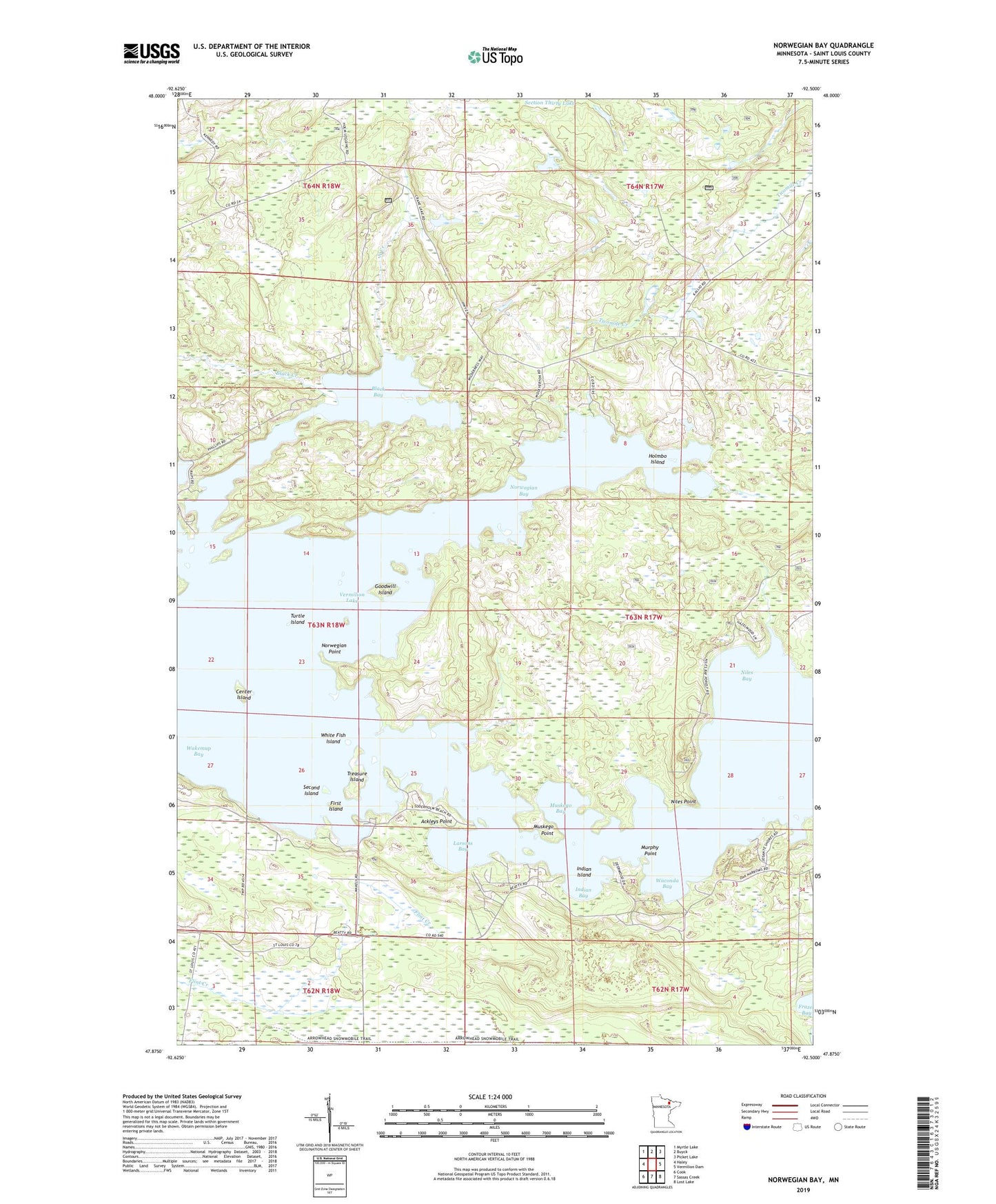
2022 topographic map quadrangle Norwegian Bay in the state of Minnesota. Scale: 1:24000. Based on the newly updated USGS 7.5' US Topo map series, this map is in the following counties: St. Louis. The map contains contour data, water features, and other items you are used to seeing on USGS maps, but also has updated roads and other features. This is the next generation of topographic maps. Printed on high-quality waterproof paper with UV fade-resistant inks.
Quads adjacent to this one:
West: Haley
Northwest: Myrtle Lake
North: Buyck
Northeast: Picket Lake
East: Vermilion Dam
Southeast: Lost Lake
South: Sassas Creek
Southwest: Cook
This map covers the same area as the classic USGS quad with code o47092h5.
Contains the following named places: Ackleys Point, Barnes Seaplane Base, Black Bay, Black Creek, Center Island, First Island, Goodwill Island, Holmbo Island, Indian Bay, Indian Island, Larsons Bay, Murphy Point, Muskego Bay, Muskego Point, Niles Bay, Niles Point, North Creek, Norwegian Bay, Norwegian Point, Second Island, Treasure Island, Turtle Island, Unorganized Territory of Lake Vermilion, Waconda Bay, Wakemup Bay, Wakemup Bay Campground, White Fish Island