MyTopo
Vermilion Dam Minnesota US Topo Map
Couldn't load pickup availability
Also explore the Vermilion Dam Forest Service Topo of this same quad for updated USFS data
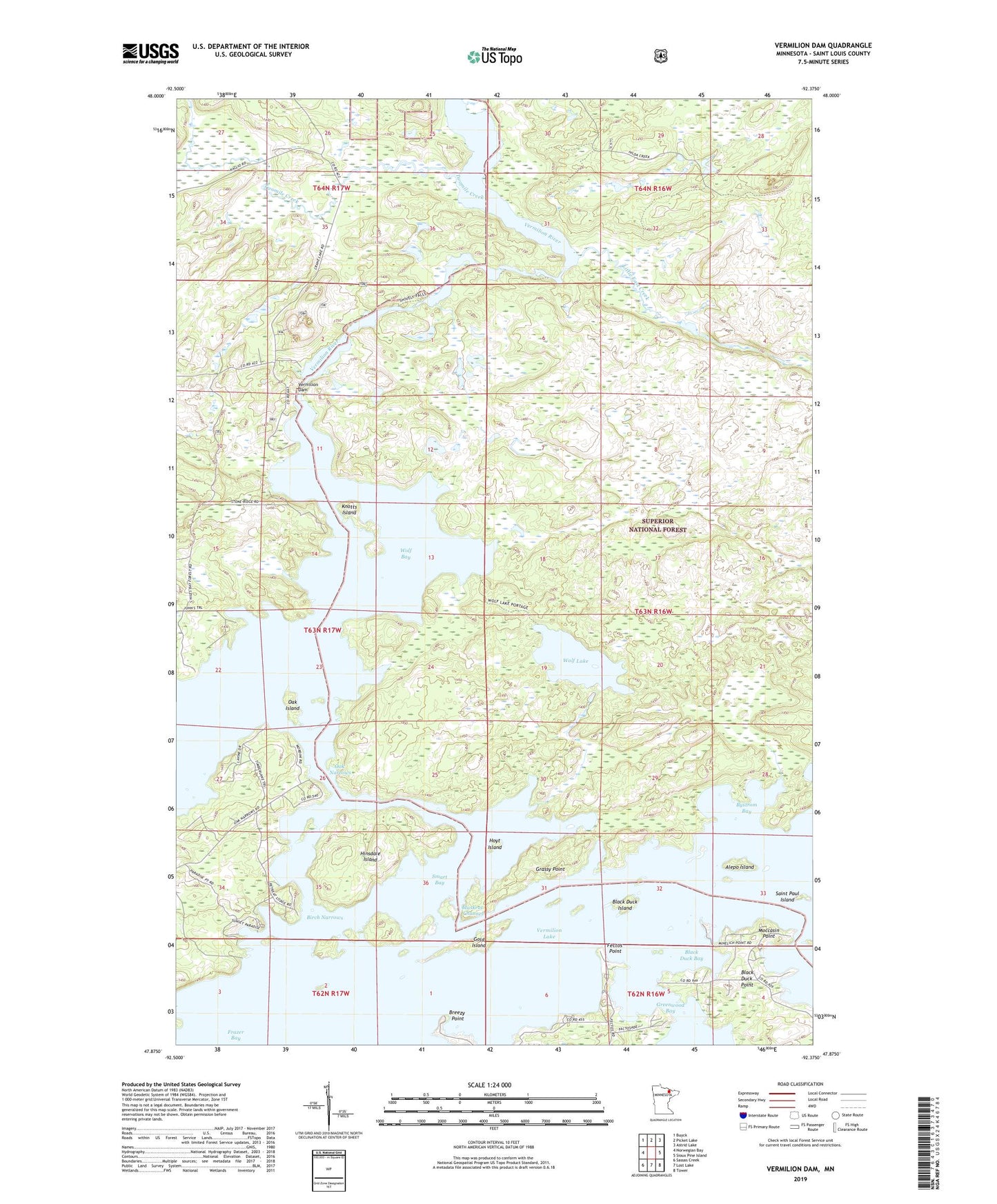
2022 topographic map quadrangle Vermilion Dam in the state of Minnesota. Scale: 1:24000. Based on the newly updated USGS 7.5' US Topo map series, this map is in the following counties: St. Louis. The map contains contour data, water features, and other items you are used to seeing on USGS maps, but also has updated roads and other features. This is the next generation of topographic maps. Printed on high-quality waterproof paper with UV fade-resistant inks.
Quads adjacent to this one:
West: Norwegian Bay
Northwest: Buyck
North: Picket Lake
Northeast: Astrid Lake
East: Sioux Pine Island
Southeast: Tower
South: Lost Lake
Southwest: Sassas Creek
This map covers the same area as the classic USGS quad with code o47092h4.
Contains the following named places: Alepo Island, Birch Narrows, Black Duck Bay, Black Duck Island, Black Duck Point, Breezy Point, Bystrom Bay, Fectos Point, Frazer Bay, Gold Island, Grassy Point, Greenwood Bay, Hinsdale Island, Hinsdale Island Campground, Hoyt Island, Knotts Island, Little East Creek, Moccasin Point, Muskrat Channel, Oak Island, Oak Narrows, Peils Vermillion Wings Seaplane Base, Saint Paul Island, Smart Bay, Township of Greenwood, Twomile Creek, Vermilion Dam, Vermilion Dam Club, Vermilion Dam Lookout Tower, Wolf Bay, Wolf Creek, Wolf Lake