MyTopo
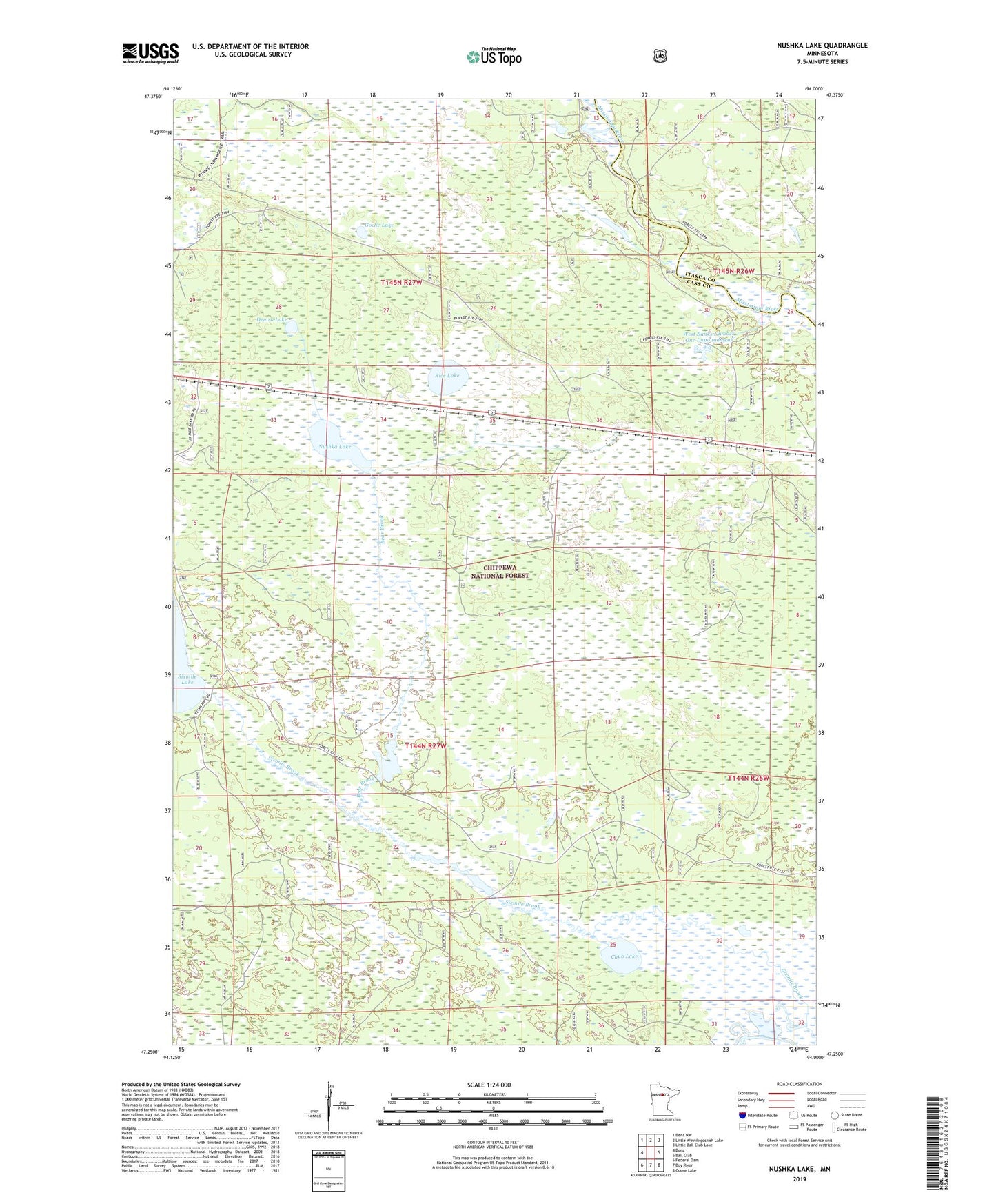
Nushka Lake Minnesota US Topo Map
Couldn't load pickup availability
Also explore the Nushka Lake Forest Service Topo of this same quad for updated USFS data
2022 topographic map quadrangle Nushka Lake in the state of Minnesota. Scale: 1:24000. Based on the newly updated USGS 7.5' US Topo map series, this map is in the following counties: Cass, Itasca. The map contains contour data, water features, and other items you are used to seeing on USGS maps, but also has updated roads and other features. This is the next generation of topographic maps. Printed on high-quality waterproof paper with UV fade-resistant inks.
Quads adjacent to this one:
West: Bena
Northwest: Bena NW
North: Little Winnibigoshish Lake
Northeast: Little Ball Club Lake
East: Ball Club
Southeast: Goose Lake
South: Boy River
Southwest: Federal Dam
This map covers the same area as the classic USGS quad with code o47094c1.
Contains the following named places: Bear Brook, Bear Brook Dam, Bear Brook Impoundment, Chub Lake, Demro Lake, Goche Lake, Mud Lake Lookout, Mud Lake Trail System, Nushka Lake, Nushka Lookout Tower, Rice Lake, Six Mile Campground, Six Mile Creek Impoundment Dam, Six Mile Impoundment, Sixmile Brook, West Banks Number One Impoundment