MyTopo
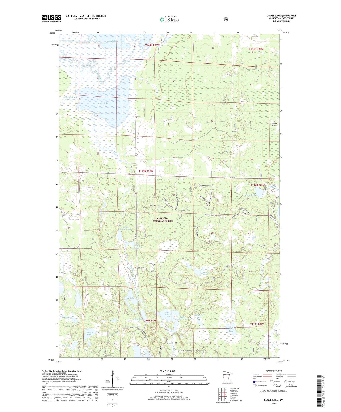
Goose Lake Minnesota US Topo Map
Couldn't load pickup availability
Also explore the Goose Lake Forest Service Topo of this same quad for updated USFS data
2022 topographic map quadrangle Goose Lake in the state of Minnesota. Scale: 1:24000. Based on the newly updated USGS 7.5' US Topo map series, this map is in the following counties: Cass. The map contains contour data, water features, and other items you are used to seeing on USGS maps, but also has updated roads and other features. This is the next generation of topographic maps. Printed on high-quality waterproof paper with UV fade-resistant inks.
Quads adjacent to this one:
West: Boy River
Northwest: Nushka Lake
North: Ball Club
Northeast: Deer River
East: Sugar Lake
Southeast: Shingle Mill Lake
South: Remer
Southwest: Tobique
This map covers the same area as the classic USGS quad with code o47093b8.
Contains the following named places: Bear River, Cedar Lake, Chain O' Lakes, Dewey Lake, Dirty Nose Lake, Elevenmile Corner, Goose Lake, Johnson Lake, Johnson Lake Trail System, Little Bear Creek, Lower Menton Lake, Lower Milton Lake, Mink Lake, Mud Goose Lake Wildlife Management Area, Sullivan Lake, Tamarack Lake, Taylor Lake, Tidd Lake, Township of Salem, Upper Menton Lake, Upper Milton Lake, Zimmerman Lake