MyTopo
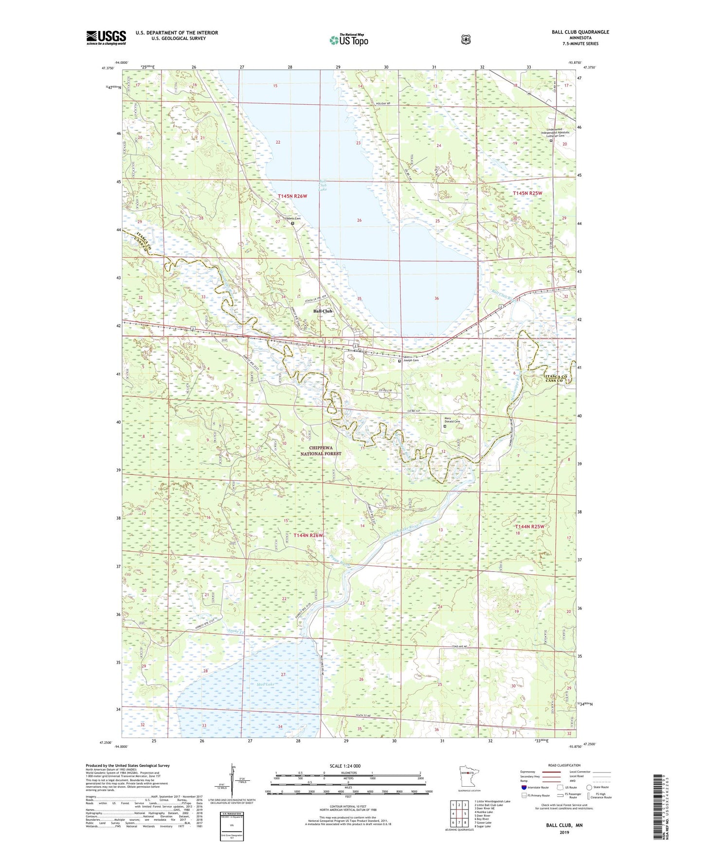
Ball Club Minnesota US Topo Map
Couldn't load pickup availability
Also explore the Ball Club Forest Service Topo of this same quad for updated USFS data
2022 topographic map quadrangle Ball Club in the state of Minnesota. Scale: 1:24000. Based on the newly updated USGS 7.5' US Topo map series, this map is in the following counties: Cass, Itasca. The map contains contour data, water features, and other items you are used to seeing on USGS maps, but also has updated roads and other features. This is the next generation of topographic maps. Printed on high-quality waterproof paper with UV fade-resistant inks.
Quads adjacent to this one:
West: Nushka Lake
Northwest: Little Winnibigoshish Lake
North: Little Ball Club Lake
Northeast: Deer River NE
East: Deer River
Southeast: Sugar Lake
South: Goose Lake
Southwest: Boy River
This map covers the same area as the classic USGS quad with code o47093c8.
Contains the following named places: Apostolic Church, Ball Club, Ball Club Assembly of God Church, Ball Club Census Designated Place, Ball Club Lake, Ball Club Post Office, Ball Club River, Leech Lake River, Lindenwood - Independent Apostolic Lutheran Cemetery, Mary Donald Cemetery, Mud Lake, Mud-Goose Lake, Mud-Goose Lake Dam, Peggy Brook, Saint Joseph Cemetery, Saint Joseph's Catholic Church, Snake Brook Impoundment, Snake Creek, Tibbetts Cemetery