MyTopo
Ogishkemuncie Lake Minnesota US Topo Map
Couldn't load pickup availability
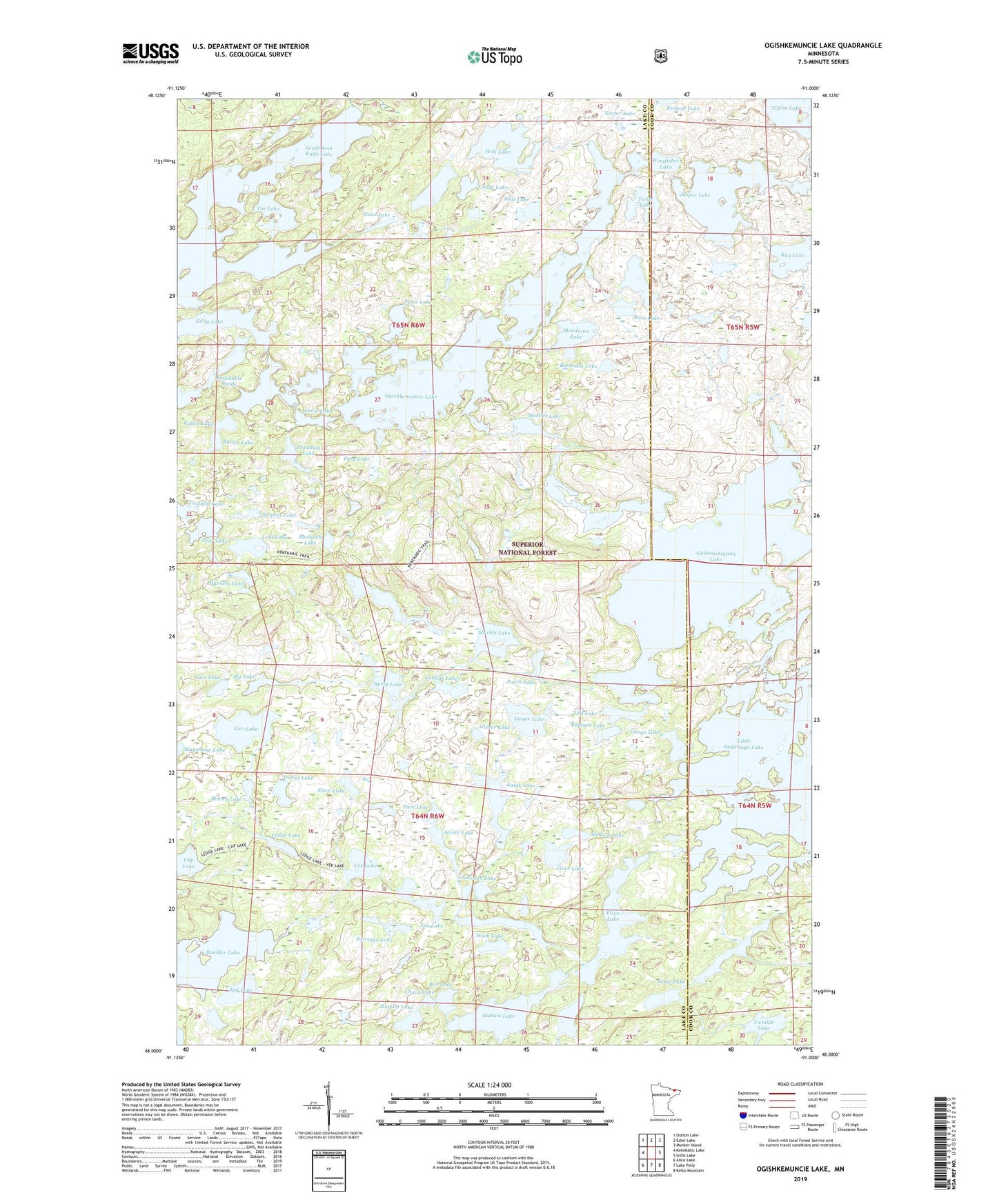
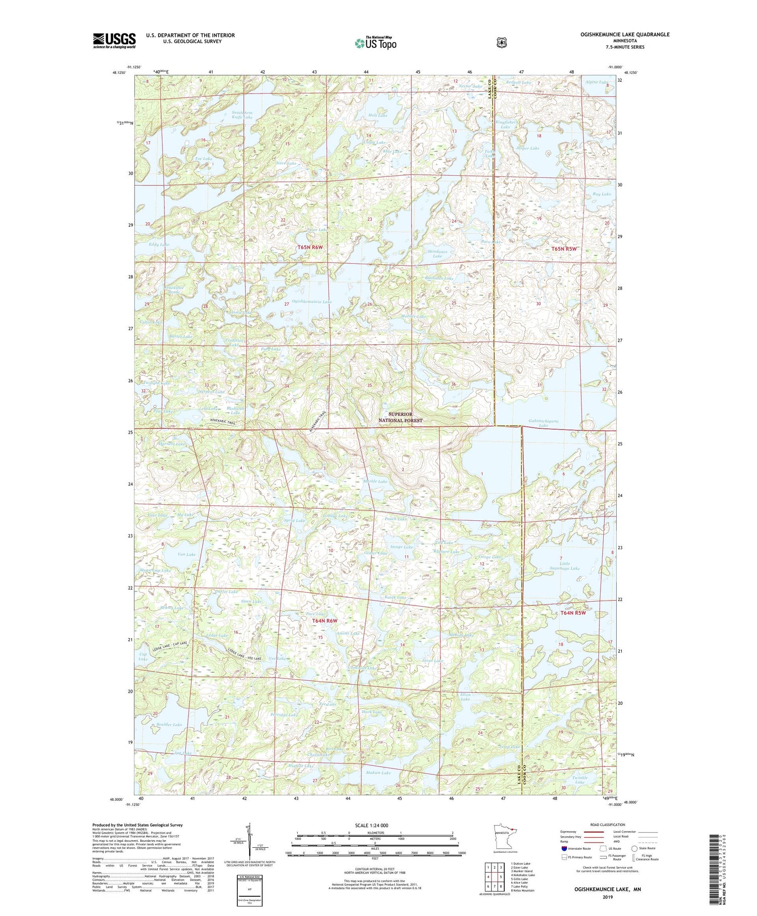
2019 topographic map quadrangle Ogishkemuncie Lake in the state of Minnesota. Scale: 1:24000. Based on the newly updated USGS 7.5' US Topo map series, this map is in the following counties: Lake, Cook. The map contains contour data, water features, and other items you are used to seeing on USGS maps, but also has updated roads and other features. This is the next generation of topographic maps. Printed on high-quality waterproof paper with UV fade-resistant inks.
Quads adjacent to this one:
West: Kekekabic Lake
Northwest: Dutton Lake
North: Ester Lake
Northeast: Munker Island
East: Gillis Lake
Southeast: Kelso Mountain
South: Lake Polly
Southwest: Alice Lake
Contains the following named places: Agamok Lake, Amimi Lake, Annie Lake, Barter Lake, Bewon Lake, Birl Lake, Boulder Lake, Bushman Lake, Bushwah Lake, Calico Lake, Canta Lake, Cap Lake, Churn Lake, Cook County Lake, Cookoosh Lake, Darlet Lake, Eddy Lake, Elton Lake, Fee Lake, Fury Lake, Gabimichigami Lake, Glitter Lake, Hack Lake, Harness Lake, Hoe Lake, Holt Lake, Hop Lake, Horsefish Lake, Hotfoot Lake, Image Lake, Incus Lake, Jasper Lake, Jenny Lake, Jug Lake, Jump Lake, Kaiak Lake, Kale Lake, Kallio Lake, Kekekabic Ponds, Kingfisher Lake, Ledge Lake, Leg Lake, Little Saganaga Lake, Loki Lake, Lounge Lake, Makwa Lake, Marble Lake, Maymay Lake, Median Lake, Mueller Lake, My Lake, Nabek Lake, Nave Lake, Nectar Lake, Ogishkemuncie Lake, Pace Lake, Paco Lake, Pear Lake, Porridge Lake, Pouch Lake, Rapture Lake, Rattle Lake, Ray Lake, Serpent Lake, Siren Lake, Skindance Lake, Spice Lake, Sprig Lake, Tickle Lake, Toe Lake, Tradition Lake, Travois Lake, Twilight Lake, Twinkle Lake, Van Lake, Vee Lake, Vierge Lake, Your Lake