MyTopo
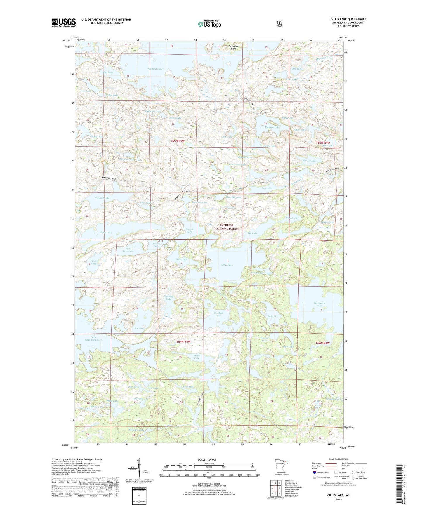
Gillis Lake Minnesota US Topo Map
Couldn't load pickup availability
Also explore the Gillis Lake Forest Service Topo of this same quad for updated USFS data
2022 topographic map quadrangle Gillis Lake in the state of Minnesota. Scale: 1:24000. Based on the newly updated USGS 7.5' US Topo map series, this map is in the following counties: Cook. The map contains contour data, water features, and other items you are used to seeing on USGS maps, but also has updated roads and other features. This is the next generation of topographic maps. Printed on high-quality waterproof paper with UV fade-resistant inks.
Quads adjacent to this one:
West: Ogishkemuncie Lake
Northwest: Ester Lake
North: Munker Island
Northeast: Conners Island
East: Long Island Lake
Southeast: Cherokee Lake
South: Kelso Mountain
Southwest: Lake Polly
This map covers the same area as the classic USGS quad with code o48090a8.
Contains the following named places: Acorn Lake, Arc Lake, Ballyhoo Lake, Bat Lake, Bingshick Lake, Bonita Lake, Cavity Lake, Chip Lake, Chub River, Crag Lake, Crooked Lake, Ecstasy Lake, Ellquist Lake, Elm Lake, Elusion Lake, Everett Lake, Fay Lake, Fern Lake, Fishgig Lake, Flap Lake, Flint Lake, Flying Lake, French Lake, Gillis Lake, Glee Lake, Glossy Lake, Gotter Lake, Green Lake, Honker Lake, Hooter Lake, Howard Lake, Hummitch Lake, Jam Lake, Jerry Lake, Jig Lake, Jimmy Lake, Leaf Lake, Loop Lake, Mina Lake, Mora Lake, Ogle Lake, Owl Lake, Paulson Lake, Pellet Lake, Peter Lake, Powell Lake, Rally Lake, Rog Lake, Rumpuss Lake, Seahorse Lake, Squat Lake, Tarry Lake, Tern Lake, Time Lake, Tuscarora Lake, Virgin Lake, Warclub Lake, West Fern Lake, Whipped Lake