MyTopo
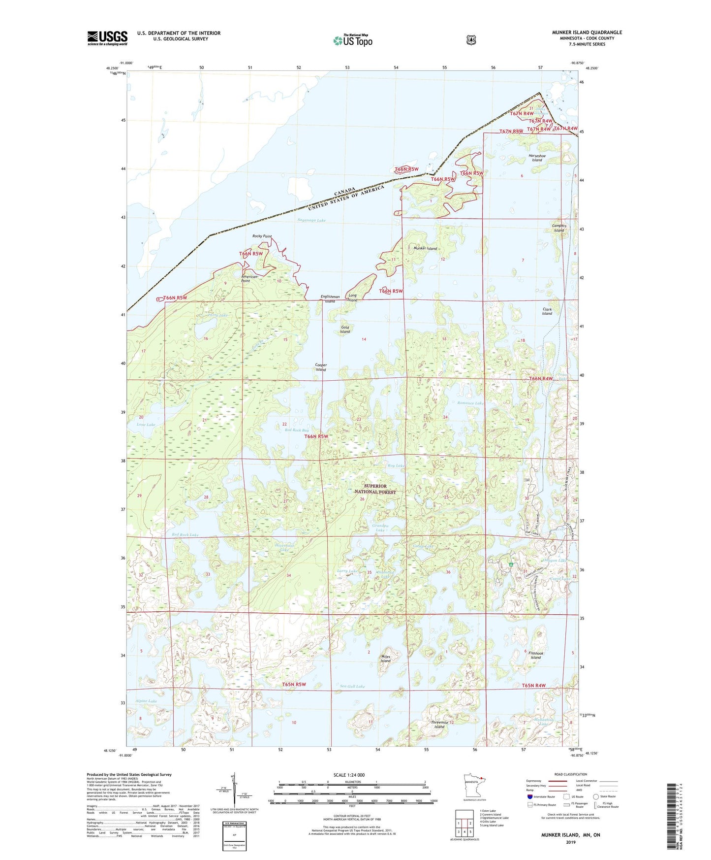
Munker Island Minnesota US Topo Map
Couldn't load pickup availability
Also explore the Munker Island Forest Service Topo of this same quad for updated USFS data
2022 topographic map quadrangle Munker Island in the state of Minnesota. Scale: 1:24000. Based on the newly updated USGS 7.5' US Topo map series, this map is in the following counties: Cook. The map contains contour data, water features, and other items you are used to seeing on USGS maps, but also has updated roads and other features. This is the next generation of topographic maps. Printed on high-quality waterproof paper with UV fade-resistant inks.
Quads adjacent to this one:
West: Ester Lake
East: Conners Island
Southeast: Long Island Lake
South: Gillis Lake
Southwest: Ogishkemuncie Lake
This map covers the same area as the classic USGS quad with code o48090b8.
Contains the following named places: Alpine Lake, American Point, Campers Island, Clark Island, Cooper Island, Cupid Lake, Diamond Lake, Englishman Island, Fishhook Island, Gold Island, Grandpa Lake, Gulf Lake, Gull Lake, Gump Lake, Hivernant Lake, Horseshoe Island, Jocks Narrows, Larry Lake, Lone Creek, Lone Lake, Long Island, Meditation Lake, Miles Island, Munker Island, Onagon Lake, Party Lake, Red Rock Bay, Red Rock Lake, Rocky Point, Romance Lake, Roy Lake, Saganaga Lake, Sea Gull Lake, Sea Gull River, Sea Gull River Boat Landing, Tenor Lake, Threemile Island, Trails End