MyTopo
Palisade Minnesota US Topo Map
Couldn't load pickup availability
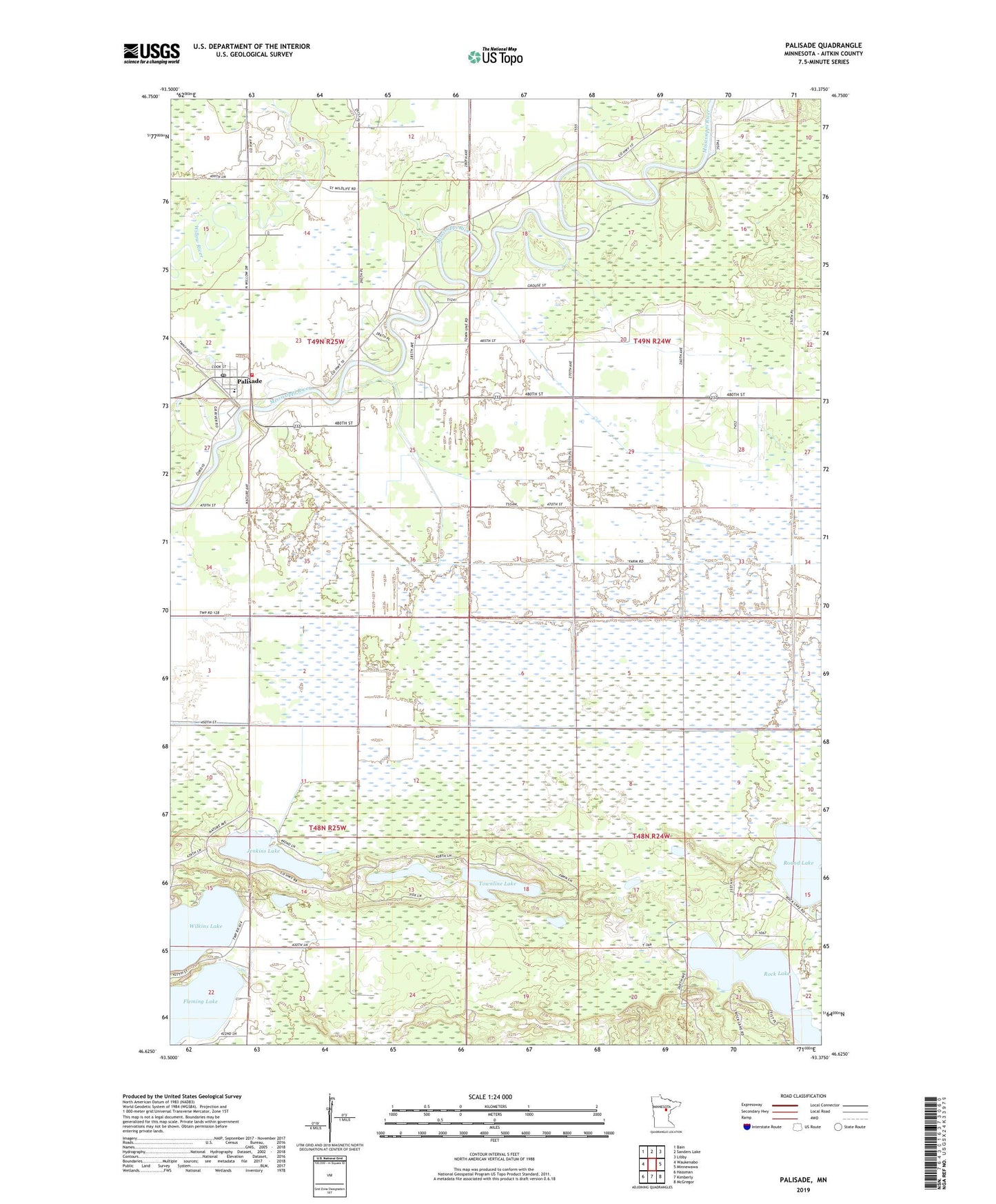
2019 topographic map quadrangle Palisade in the state of Minnesota. Scale: 1:24000. Based on the newly updated USGS 7.5' US Topo map series, this map is in the following counties: Aitkin. The map contains contour data, water features, and other items you are used to seeing on USGS maps, but also has updated roads and other features. This is the next generation of topographic maps. Printed on high-quality waterproof paper with UV fade-resistant inks.
Quads adjacent to this one:
West: Waukenabo
Northwest: Bain
North: Sanders Lake
Northeast: Libby
East: Minnewawa
Southeast: McGregor
South: Kimberly
Southwest: Hassman
Contains the following named places: Berglund Park Campground, Bethel Lutheran Church, City of Palisade, Fleming Lake, Fleming Lake Post Office, Jenkins Lake, Long Lake, Palisade, Palisade Assemblies of God Church, Palisade City Hall, Palisade Police Department, Palisade Post Office, Palisade School, Palisade Volunteer Fire Department, Roberts-Wickstrrom Wildlife Management Area, Rock Lake, Round Lake, Townline Lake, Township of Jevne, Township of Workman, Wilkins Lake