
MyTopo
Palo Minnesota US Topo Map
Couldn't load pickup availability
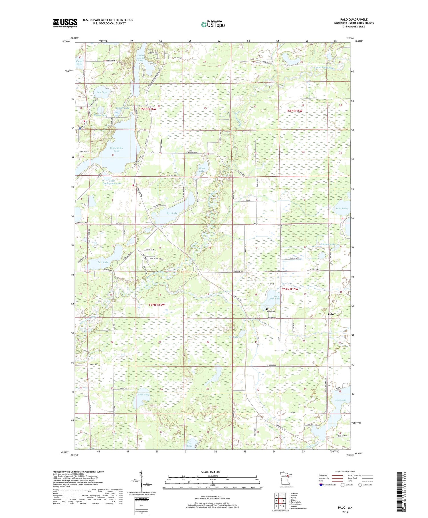
2019 topographic map quadrangle Palo in the state of Minnesota. Scale: 1:24000. Based on the newly updated USGS 7.5' US Topo map series, this map is in the following counties: St. Louis. The map contains contour data, water features, and other items you are used to seeing on USGS maps, but also has updated roads and other features. This is the next generation of topographic maps. Printed on high-quality waterproof paper with UV fade-resistant inks.
Quads adjacent to this one:
West: Gilbert
Northwest: McKinley
North: Biwabik
Northeast: Aurora
East: Turpela Lake
Southeast: Whiteface Reservoir
South: Makinen
Southwest: Central Lakes
Contains the following named places: Bass Lake, Biwabik Township Fire Department, Biwabik Township Police Department, Camp Sigel, Cedar Island Lake, Cedar Lake, Coe Lake, Esquagama Club, Esquagama Lake, Forge Lake, Four H Camp, Fourth Lake, Frying Pan Lake, Kahtava Lake, Lakeland Volunteer Fire Department, Little Esquagama Lake, Loon Lake, Loon Lake School, Lost Lake, Mamrelund Church, North Twin Lake, Palo, Palo Congregational Church, Palo Post Office, Palo Regional Volunteer Fire Department, Pot Lake, Rauha Cemetery, Round Lake, Saint Louis River Hall, Saint Marks Lutheran Church, Salt Lake, Silver Lake, Tikander Lake, Township of Biwabik, Twin Lakes, Unorganized Territory of Tikander Lake


