MyTopo
Kawishiwi Lake Minnesota US Topo Map
Couldn't load pickup availability
Also explore the Kawishiwi Lake Forest Service Topo of this same quad for updated USFS data
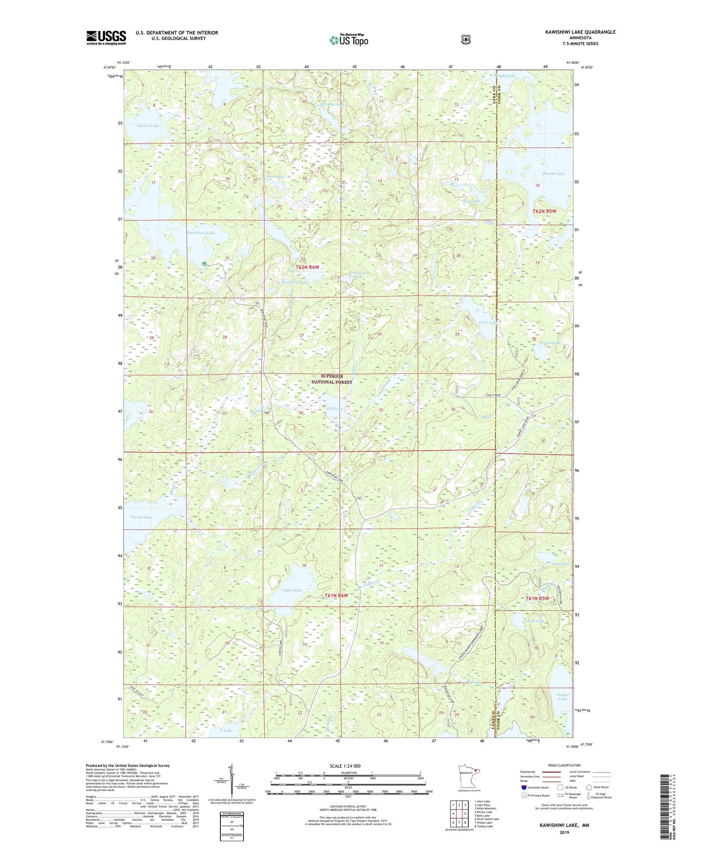
2022 topographic map quadrangle Kawishiwi Lake in the state of Minnesota. Scale: 1:24000. Based on the newly updated USGS 7.5' US Topo map series, this map is in the following counties: Lake, Cook. The map contains contour data, water features, and other items you are used to seeing on USGS maps, but also has updated roads and other features. This is the next generation of topographic maps. Printed on high-quality waterproof paper with UV fade-resistant inks.
Quads adjacent to this one:
West: Perent Lake
Northwest: Alice Lake
North: Lake Polly
Northeast: Kelso Mountain
East: Beth Lake
Southeast: Toohey Lake
South: Wilson Lake
Southwest: Silver Island Lake
This map covers the same area as the classic USGS quad with code o47091g1.
Contains the following named places: Bag Lake, Bill Creek, Bill Lake, Bone Creek, Bone Lake, Cat Eyes Lake, Coffee Creek, Coffee Lake, Cook Lake, Gobetween Lake, Hog Creek, Kawasachong Lake, Kawishiwi Lake, Kawishiwi Lake Campground, Knight Lake, Last Lake, Legat Creek, Legat Lake, Phoebe Lake, Poet Lake, Short Lake, Single Lake, Square Lake, Stringer Lake, Sundown Lake, Walter Creek, Watonwan Lake