MyTopo
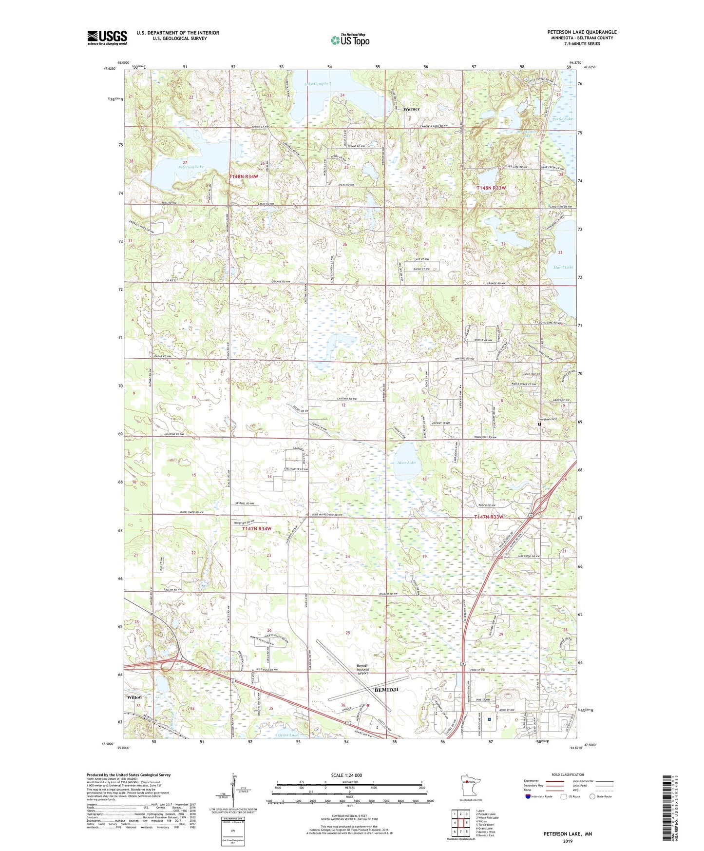
Peterson Lake Minnesota US Topo Map
Couldn't load pickup availability
2019 topographic map quadrangle Peterson Lake in the state of Minnesota. Scale: 1:24000. Based on the newly updated USGS 7.5' US Topo map series, this map is in the following counties: Beltrami. The map contains contour data, water features, and other items you are used to seeing on USGS maps, but also has updated roads and other features. This is the next generation of topographic maps. Printed on high-quality waterproof paper with UV fade-resistant inks.
Quads adjacent to this one:
West: Wilton
Northwest: Aure
North: Puposky Lake
Northeast: White Fish Lake
East: Turtle River
Southeast: Bemidji East
South: Bemidji West
Southwest: Grant Lake
Contains the following named places: Alice Lake, Bemidji Ambulance Service, Bemidji Fire Department Station 3, Bemidji Regional Airport, Bemidji Seventh Day Adventist Church, Bethel Lutheran Church, Chapel in the Pines, City of Wilton, Des Moines Lake, Evangelical Covenant Church, Heartland Christian Academy, Horseman Lake, KOA Kampgrounds, Lake Campbell, Meadow Lake, Merit Care Clinic, Movil Lake Trailer Park, North Memorial Ambulance Service Bemidji, Northern Bible Church, Northern Cemetery, Northern School, Northern Trailer Park, Peterson Lake, Saint Mark's Evangelical Lutheran Church, Saint Mark's Lutheran School, Sanford Bemidji Medical Center, Secluded Acres, Seventh Day Adventist School, Spaulding Post Office, Spaulding Station, Township of Eckles, Victory Assembly of God Church, Werner, ZIP Code: 56687