MyTopo
Pigeon Dam Lake Minnesota US Topo Map
Couldn't load pickup availability
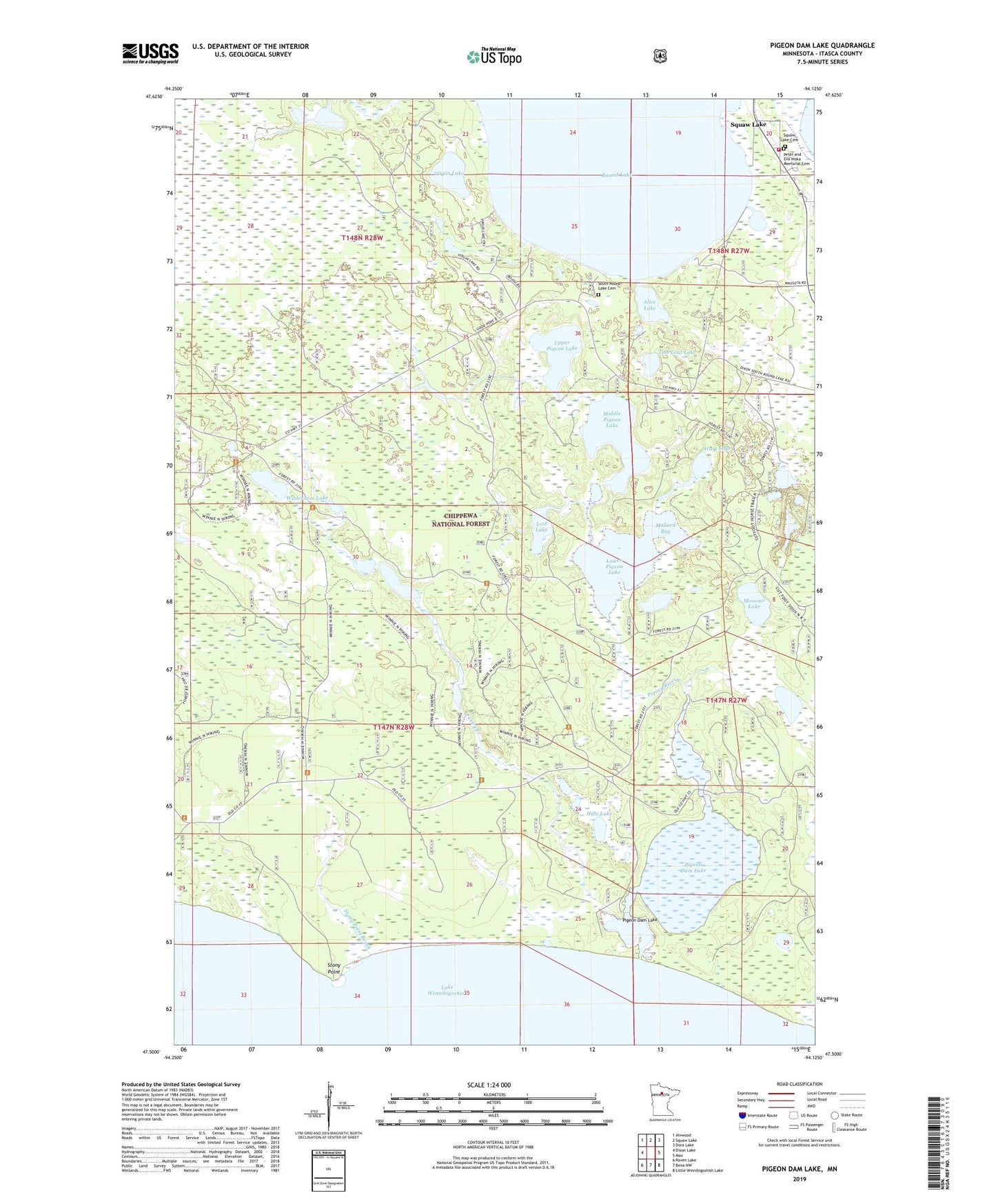
2019 topographic map quadrangle Pigeon Dam Lake in the state of Minnesota. Scale: 1:24000. Based on the newly updated USGS 7.5' US Topo map series, this map is in the following counties: Itasca. The map contains contour data, water features, and other items you are used to seeing on USGS maps, but also has updated roads and other features. This is the next generation of topographic maps. Printed on high-quality waterproof paper with UV fade-resistant inks.
Quads adjacent to this one:
West: Dixon Lake
Northwest: Alvwood
North: Squaw Lake
Northeast: Dora Lake
East: Max
Southeast: Little Winnibigoshish Lake
South: Bena NW
Southwest: Raven Lake
Contains the following named places: Alice Lake, Dunbar River, Farley Creek, Farley Hill Lookout Tower, Farley Lakes, Hale Lake, Lost Lake, Lower Pigeon Lake, Lower Pigeon Lake Game Refuge, Lower Twin Lakes, Mallard Bay, Middle Pigeon Lake, Middle Pigeon River Campground, Mosomo Lake, One Loaf Lake, Pigeon Dam Lake, Pigeon River, Pigeon River Flowage Game Refuge, Pigeon River Impoundment, Round Lake, Simpson Lake, South Round Lake Cemetery, Squaw Lake Cemetery, Squaw Lake Fire Department, Stony Point, Stony Point Brook, Upper Pigeon Lake, Virgin Lake, Wart Lake, Wilderness Lake, ZIP Code: 56681