
MyTopo
Randall West Minnesota US Topo Map
Couldn't load pickup availability
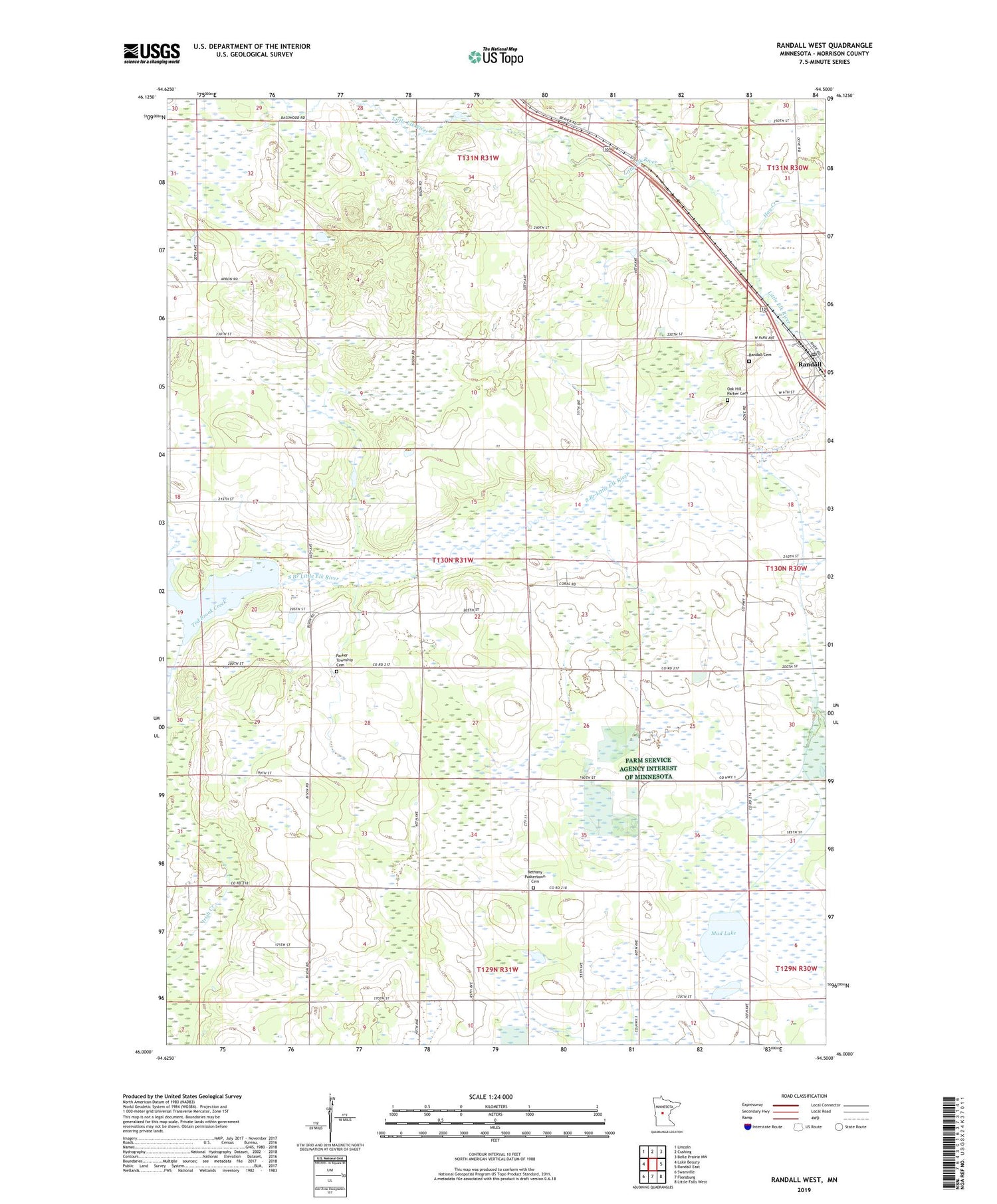
2019 topographic map quadrangle Randall West in the state of Minnesota. Scale: 1:24000. Based on the newly updated USGS 7.5' US Topo map series, this map is in the following counties: Morrison. The map contains contour data, water features, and other items you are used to seeing on USGS maps, but also has updated roads and other features. This is the next generation of topographic maps. Printed on high-quality waterproof paper with UV fade-resistant inks.
Quads adjacent to this one:
West: Lake Beauty
Northwest: Lincoln
North: Cushing
Northeast: Belle Prairie NW
East: Randall East
Southeast: Little Falls West
South: Flensburg
Southwest: Swanville
Contains the following named places: Bethany Church, Bethany Parkertown Cemetery, Chandler Field, City of Randall, Hay Creek, Mud Lake, Mud Lake State Wildlife Management Area, Oak Hill Parker Cemetery, Parker Town Hall, Parker Township Cemetery, Randall, Randall Cemetery, Randall Police Department, Randall Post Office, Saint Peter Lutheran Church, School Number 100, School Number 106, School Number 128, School Number 140, School Number 153, School Number 30, School Number 65, School Number 85, School Number 93, Ted Brook Creek, Township of Parker, ZIP Code: 56475


