MyTopo
Belle Prairie NW Minnesota US Topo Map
Couldn't load pickup availability
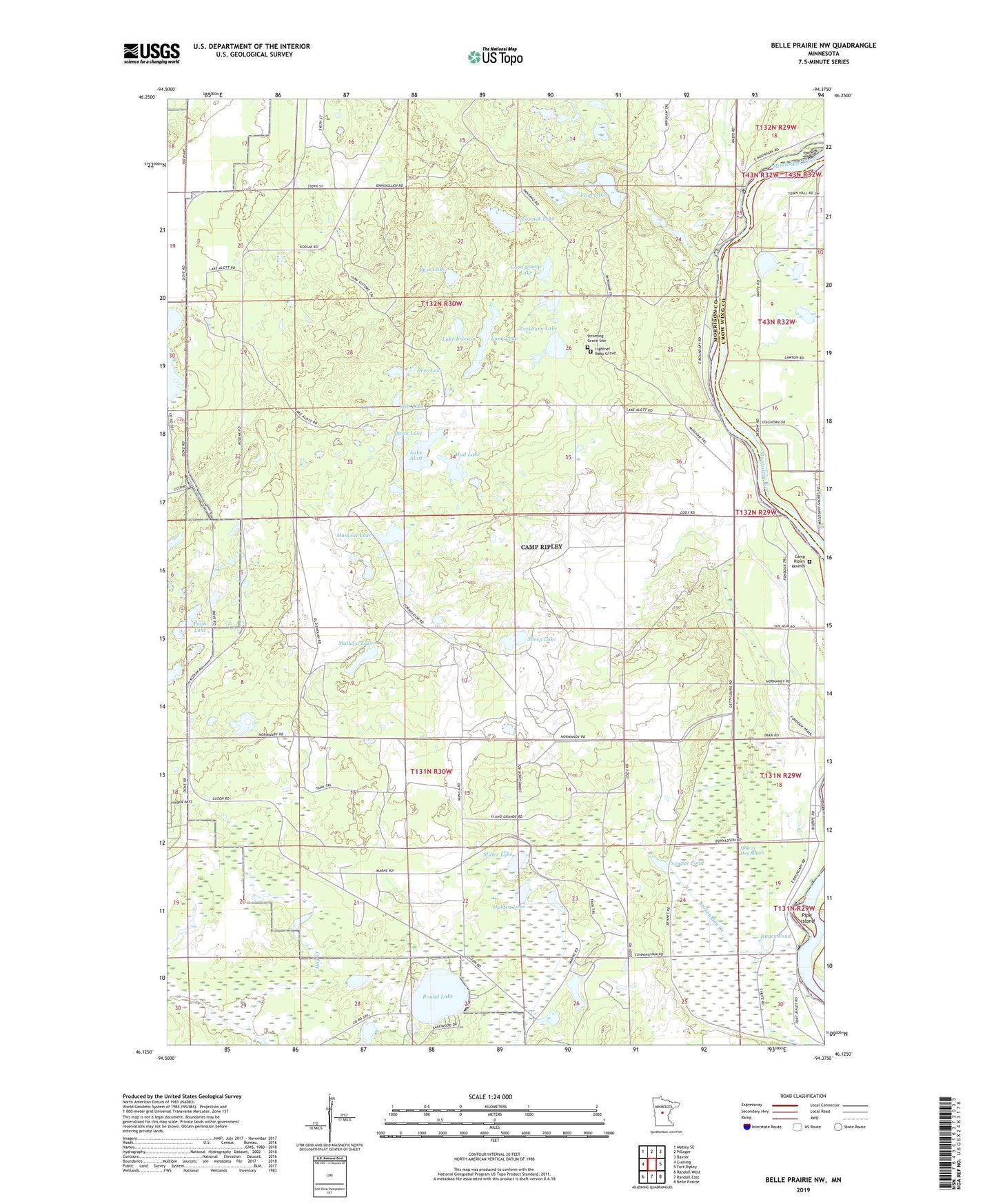
2022 topographic map quadrangle Belle Prairie NW in the state of Minnesota. Scale: 1:24000. Based on the newly updated USGS 7.5' US Topo map series, this map is in the following counties: Morrison, Crow Wing. The map contains contour data, water features, and other items you are used to seeing on USGS maps, but also has updated roads and other features. This is the next generation of topographic maps. Printed on high-quality waterproof paper with UV fade-resistant inks.
Quads adjacent to this one:
West: Cushing
Northwest: Motley SE
North: Pillager
Northeast: Baxter
East: Fort Ripley
Southeast: Belle Prairie
South: Randall East
Southwest: Randall West
This map covers the same area as the classic USGS quad with code o46094b4.
Contains the following named places: Bass Lake, Broken Bow Creek, Camp Ripley, Camp Ripley Mounds, Cockburn Lake, Coon Stump Lake, Deer Lake, Fosdick Lake, Frog Lake, Hager Pond, Holden Lake, Hole in Day Marsh, Lake Alott, Lake Ericson, Lightner Baby Grave, Long Lake, Mallard Lake, Miller Lake, Mud Lake, Muskrat Lake, Pipe Island, Prentice Pond, Pugh Lake, Quick Lake, Round Lake, School Number 47, Sheep Lake, Still Lake, Stroming Grave Site, Township of Rail Prairie