MyTopo
Ranum Minnesota US Topo Map
Couldn't load pickup availability
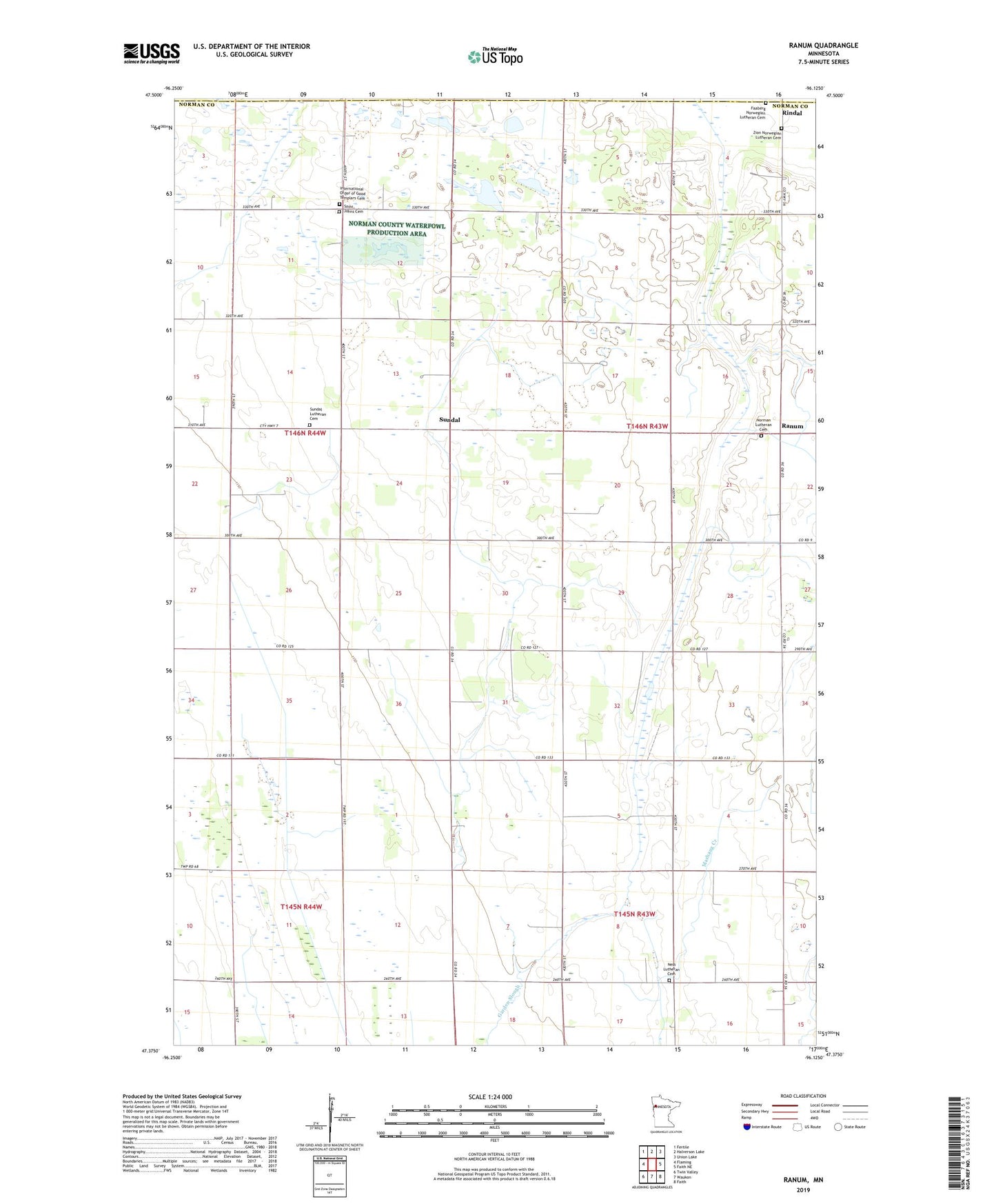
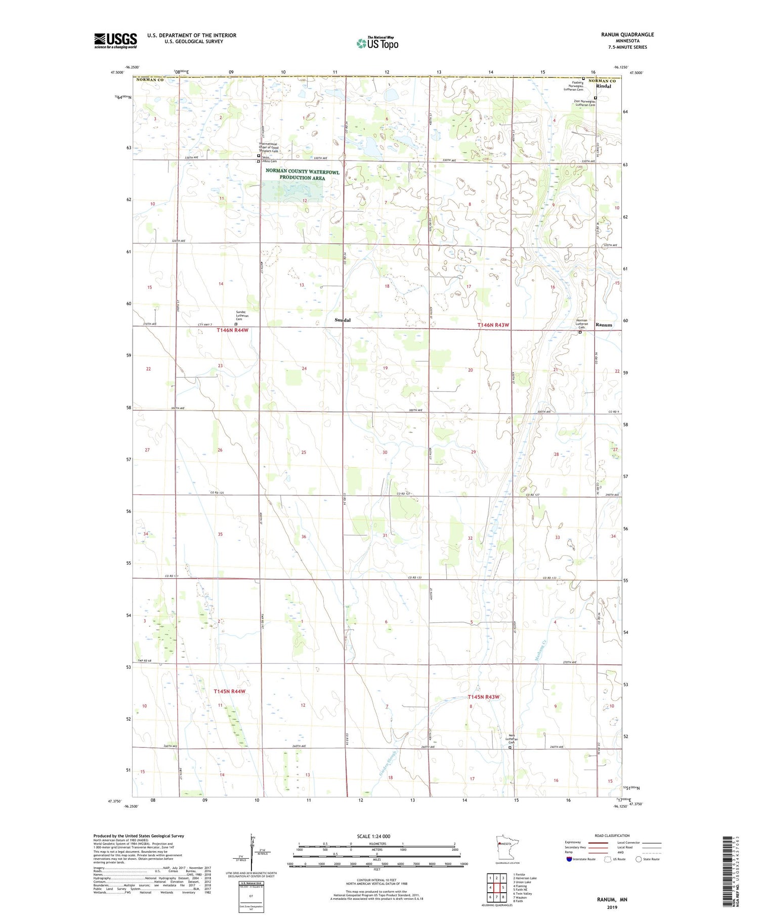
2019 topographic map quadrangle Ranum in the state of Minnesota. Scale: 1:24000. Based on the newly updated USGS 7.5' US Topo map series, this map is in the following counties: Norman, Polk. The map contains contour data, water features, and other items you are used to seeing on USGS maps, but also has updated roads and other features. This is the next generation of topographic maps. Printed on high-quality waterproof paper with UV fade-resistant inks.
Quads adjacent to this one:
West: Flaming
Northwest: Fertile
North: Halverson Lake
Northeast: Union Lake
East: Faith NE
Southeast: Faith
South: Waukon
Southwest: Twin Valley
Contains the following named places: County Ditch Number Fortytwo, County Ditch Number Six, Faaberg Lutheran Cemetery, International Order of Good Templars Cemetery, Ness Church, Ness Lutheran Cemetery, Norman Lutheran Cemetery, Ranum, Ranum Post Office, Rindal, Rindal Post Office, Saint Johns Cemetery, Saint Johns Church, Sundahl Post Office, Sundal, Sundal Church, Sundal Lutheran Cemetery, Township of Bear Park, Zion Norwegian Lutheran Cemetery, ZIP Code: 56545