MyTopo
Saint Augusta Minnesota US Topo Map
Couldn't load pickup availability
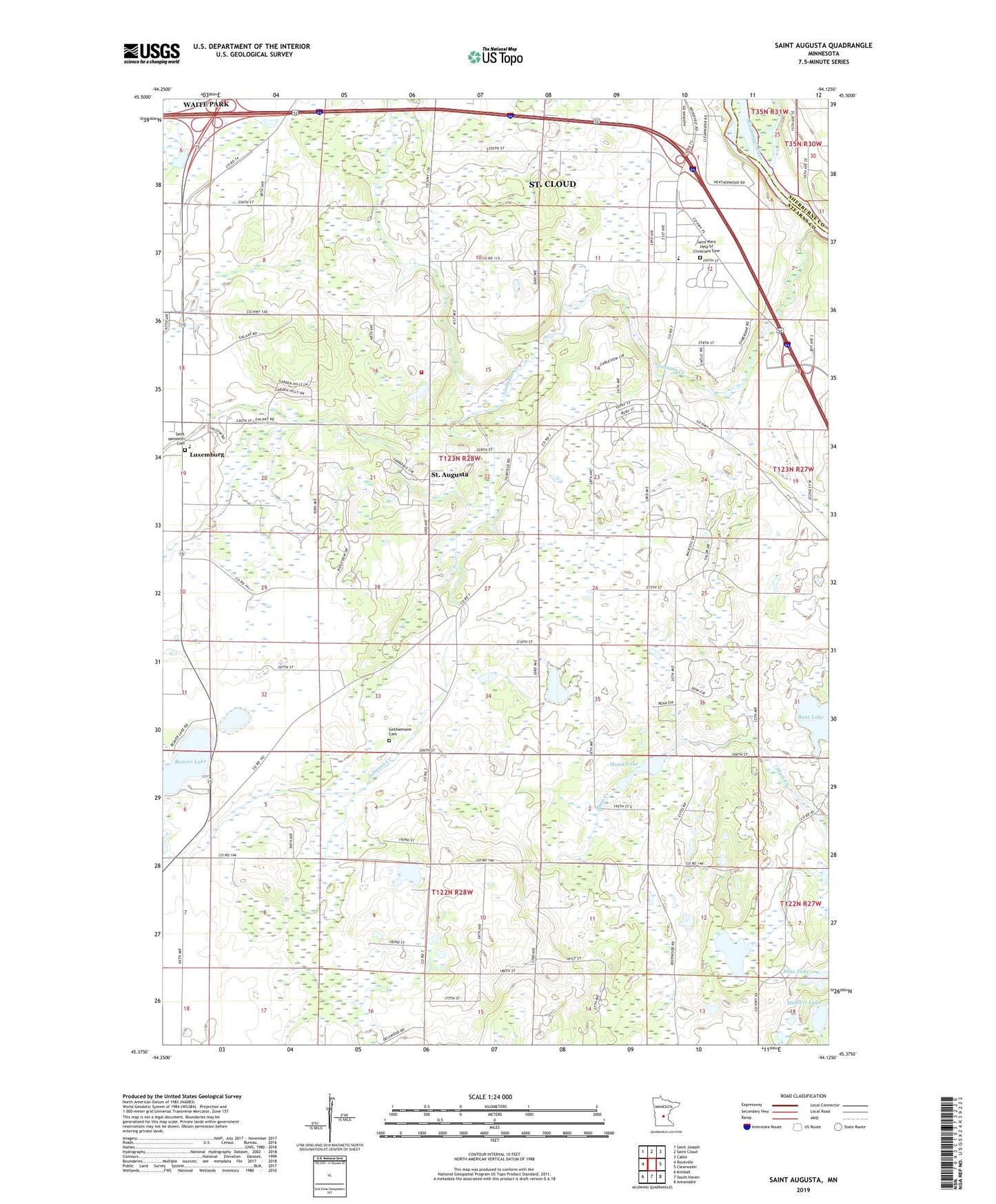
2019 topographic map quadrangle Saint Augusta in the state of Minnesota. Scale: 1:24000. Based on the newly updated USGS 7.5' US Topo map series, this map is in the following counties: Stearns, Sherburne. The map contains contour data, water features, and other items you are used to seeing on USGS maps, but also has updated roads and other features. This is the next generation of topographic maps. Printed on high-quality waterproof paper with UV fade-resistant inks.
Quads adjacent to this one:
West: Rockville
Northwest: Saint Joseph
North: Saint Cloud
Northeast: Cable
East: Clearwater
Southeast: Annandale
South: South Haven
Southwest: Kimball
Contains the following named places: Beaver Lake, Bunt Lake, City of Saint Augusta, Edgewater Estates, Gethsemane Cemetery, Hinz Lake, Hulbert Lake, Johnson Creek, KXSS-FM (Waite Park), Luxemburg, Luxemburg Post Office, Mund Lake, Saint Augusta, Saint Augusta Fire Department, Saint Augusta Post Office, Saint Mary Help of Christians Cemetery, Saint Mary Help of Christians Church, Saint Wendelin Cemetery, Saint Wendelin of Luxemburg Church, Township of Saint Augusta, ZIP Code: 56301