MyTopo
Rockville Minnesota US Topo Map
Couldn't load pickup availability
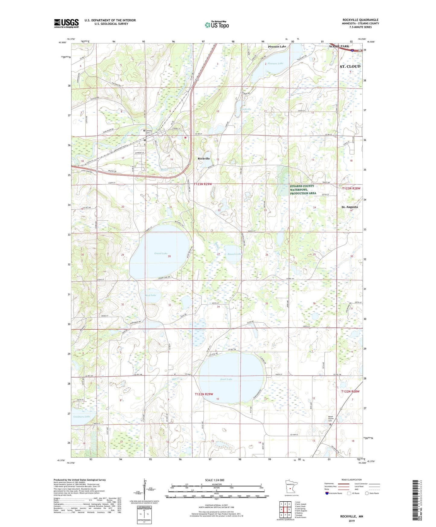
2022 topographic map quadrangle Rockville in the state of Minnesota. Scale: 1:24000. Based on the newly updated USGS 7.5' US Topo map series, this map is in the following counties: Stearns. The map contains contour data, water features, and other items you are used to seeing on USGS maps, but also has updated roads and other features. This is the next generation of topographic maps. Printed on high-quality waterproof paper with UV fade-resistant inks.
Quads adjacent to this one:
West: Cold Spring
Northwest: Avon
North: Saint Joseph
Northeast: Saint Cloud
East: Saint Augusta
Southeast: South Haven
South: Kimball
Southwest: Watkins
This map covers the same area as the classic USGS quad with code o45094d3.
Contains the following named places: Calvary Cemetery, City of Rockville, Grand Lake, Holy Cross Catholic Church, Holy Cross School, John Clark Elementary School, Maine Prairie Cemetery, Maine Prairie Corner Wayside Park, Marty, Marty Lake, Marty Post Office, Mill Creek, Mill Creek Dam, Mud Lake, Our Lady of Mount Carmel Chapel, Pearl Lake, Pleasant Lake, Rausch Lake, Rockville, Rockville City Hall, Rockville Fire Department, Rockville Lake, Rockville Post Office, School Number 2039, Township of Rockville, ZIP Code: 56369