MyTopo
Kimball Minnesota US Topo Map
Couldn't load pickup availability
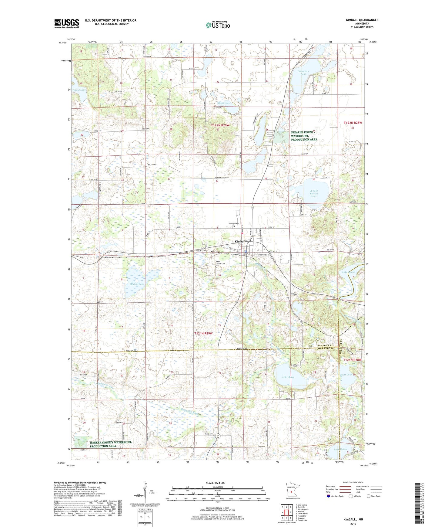
2022 topographic map quadrangle Kimball in the state of Minnesota. Scale: 1:24000. Based on the newly updated USGS 7.5' US Topo map series, this map is in the following counties: Stearns, Meeker, Wright. The map contains contour data, water features, and other items you are used to seeing on USGS maps, but also has updated roads and other features. This is the next generation of topographic maps. Printed on high-quality waterproof paper with UV fade-resistant inks.
Quads adjacent to this one:
West: Watkins
Northwest: Cold Spring
North: Rockville
Northeast: Saint Augusta
East: South Haven
Southeast: French Lake
South: Kingston
Southwest: Forest City
This map covers the same area as the classic USGS quad with code o45094c3.
Contains the following named places: Carnelian Lake, Church of Christ, Church of Saint Anne, City of Kimball, County Ditch Number Fortysix, Days Lake, Island Lake, Kimball, Kimball Cemetery, Kimball Fire Department, Kimball Golf Club, Kimball Great River Library, Kimball High School, Kimball Police Department, Kimball Post Office, Kimball Prairie Post Office, Kimball United Methodist Church, Lake Betsy, Lake Union, Murray Lake, Powder Ridge Ski Area, Saint Annes Cemetery, Saint John's Lutheran Church, School Section Lake, Scott Lake, Township of Maine Prairie, Willow Creek, Willow Lake, ZIP Code: 55353