MyTopo
Rushford East Minnesota US Topo Map
Couldn't load pickup availability
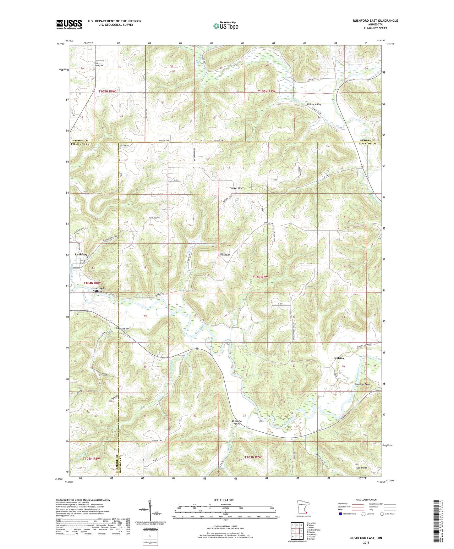
2022 topographic map quadrangle Rushford East in the state of Minnesota. Scale: 1:24000. Based on the newly updated USGS 7.5' US Topo map series, this map is in the following counties: Houston, Winona, Fillmore. The map contains contour data, water features, and other items you are used to seeing on USGS maps, but also has updated roads and other features. This is the next generation of topographic maps. Printed on high-quality waterproof paper with UV fade-resistant inks.
Quads adjacent to this one:
West: Rushford West
Northwest: Lewiston
North: Wilson
Northeast: Witoka
East: Houston
Southeast: Sheldon
South: Yucatan
Southwest: Bratsberg
This map covers the same area as the classic USGS quad with code o43091g6.
Contains the following named places: Baker Valley, Chisholm Valley, Corey Creek, Cushings Peak, Cushion Peak Overlook, Cushon's Peak Campground, Daley Creek, Ferndale Country Club, Ferndale Creek, Perkins, River of Life Regional Church, Rush Creek, Saint Johns Cemetery, Sherwood Cemetery, Township of Money Creek, Vinegar Hill