MyTopo
Sleepy Eye NW Minnesota US Topo Map
Couldn't load pickup availability
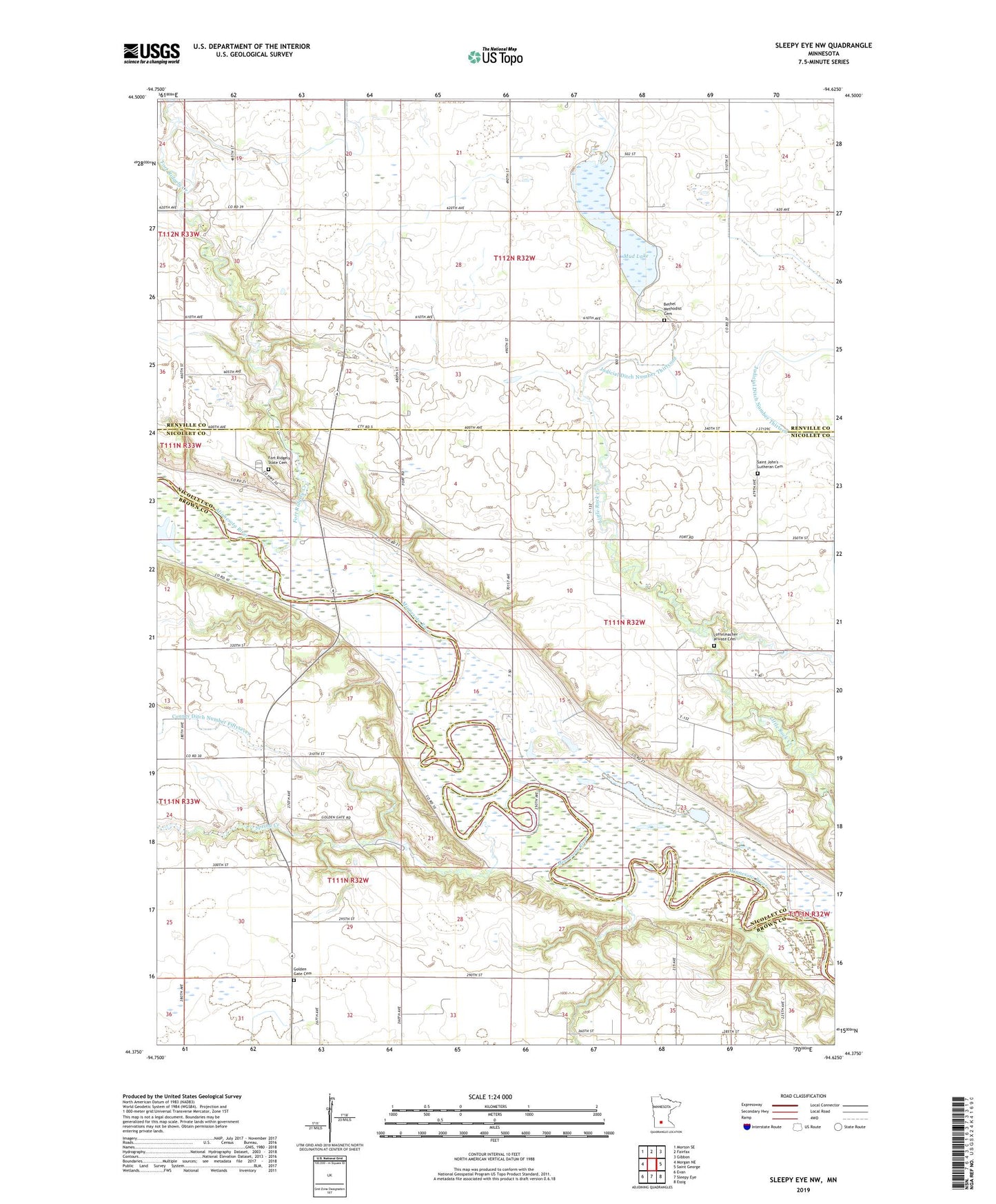
2019 topographic map quadrangle Sleepy Eye NW in the state of Minnesota. Scale: 1:24000. Based on the newly updated USGS 7.5' US Topo map series, this map is in the following counties: Renville, Brown, Nicollet. The map contains contour data, water features, and other items you are used to seeing on USGS maps, but also has updated roads and other features. This is the next generation of topographic maps. Printed on high-quality waterproof paper with UV fade-resistant inks.
Quads adjacent to this one:
West: Morgan NE
Northwest: Morton SE
North: Fairfax
Northeast: Gibbon
East: Saint George
Southeast: Essig
South: Sleepy Eye
Southwest: Evan
Contains the following named places: Battle of Fort Ridgely Historical Marker, Bethel Church, Bethel Methodist Cemetery, Chief Mouzoomaunee State Monument, Fort Ridgely Creek, Fort Ridgely State Cemetery, Fort Ridgely State Historical Site, Fort Ridgely State Monument, Fort Ridgely State Park, Golden Gate Cemetery, John S Marsh State Monument, Judicial Ditch Number Thirtyone, Loffelmacher Private Cemetery, Mrs Eliza Muller State Monument, Mud Lake, Saint Johns Church, Saint John's Lutheran Cemetery, School Number 185, Spring Creek, Township of Cairo, Township of Ridgely, Water and Ice Shape the Landscape Historical Marker