MyTopo
Solway Minnesota US Topo Map
Couldn't load pickup availability
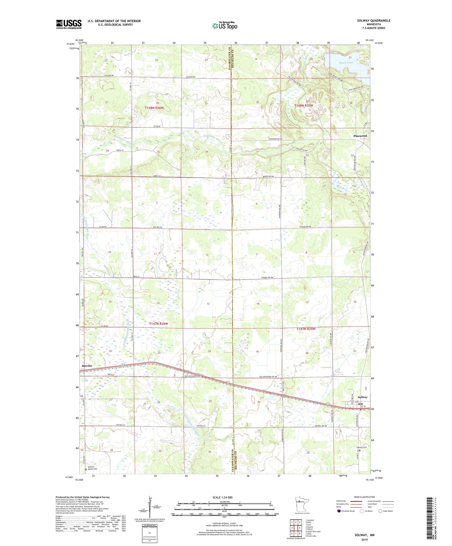
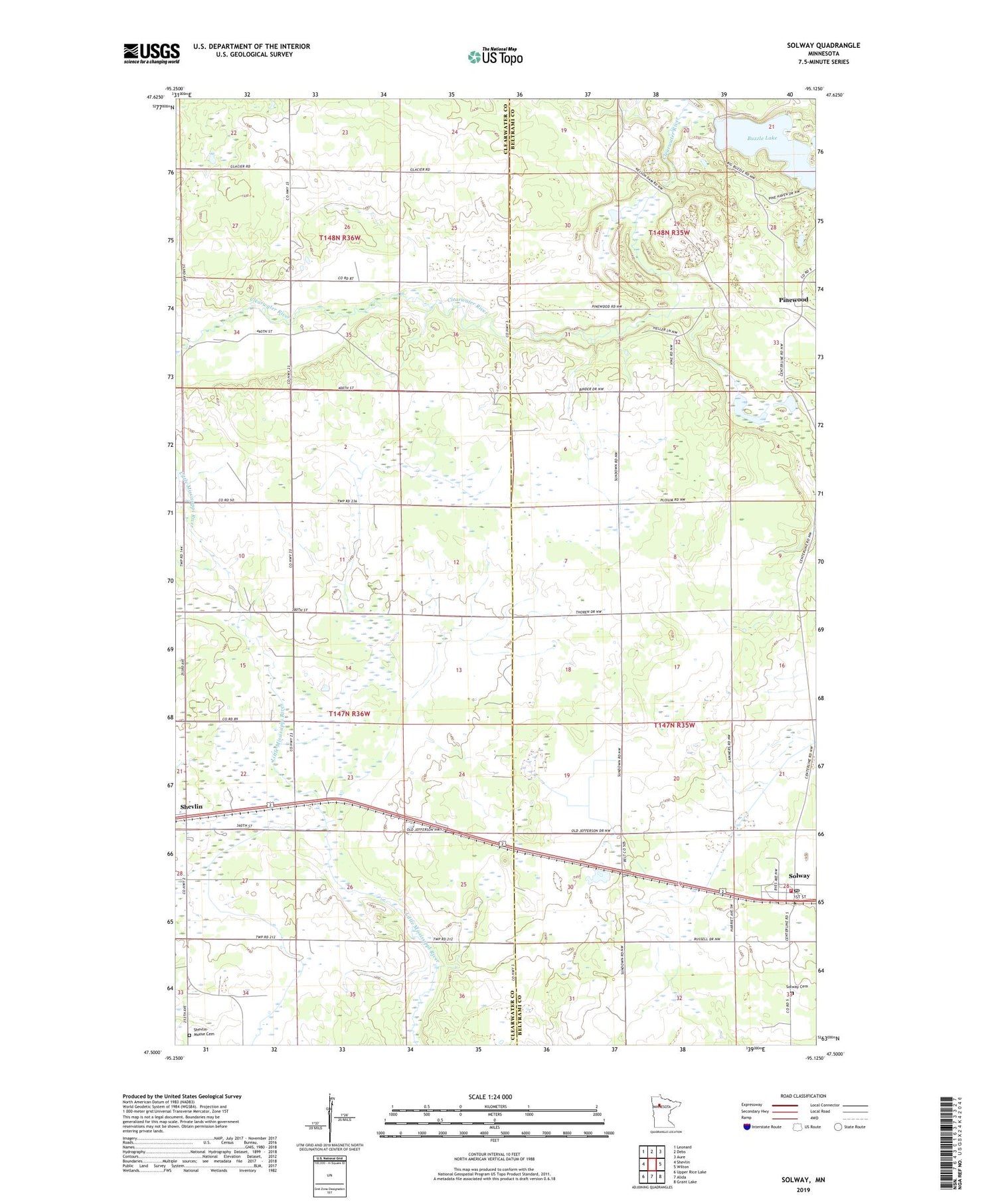
2019 topographic map quadrangle Solway in the state of Minnesota. Scale: 1:24000. Based on the newly updated USGS 7.5' US Topo map series, this map is in the following counties: Clearwater, Beltrami. The map contains contour data, water features, and other items you are used to seeing on USGS maps, but also has updated roads and other features. This is the next generation of topographic maps. Printed on high-quality waterproof paper with UV fade-resistant inks.
Quads adjacent to this one:
West: Shevlin
Northwest: Leonard
North: Debs
Northeast: Aure
East: Wilton
Southeast: Grant Lake
South: Alida
Southwest: Upper Rice Lake
Contains the following named places: Blackstar Dairy, Buzzle Lake, Buzzle Post Office, City of Solway, Lanstad Free Lutheran Church, Pinewood, Pinewood Post Office, Pinewood Station, Shevlin-Moose Cemetery, Solway, Solway Bible Chapel, Solway Cemetery, Solway Lutheran Church, Solway Post Office, Solway Rural Volunteer Fire Department, Township of Shevlin, ZIP Code: 56676