MyTopo
Spirit Lake Minnesota US Topo Map
Couldn't load pickup availability
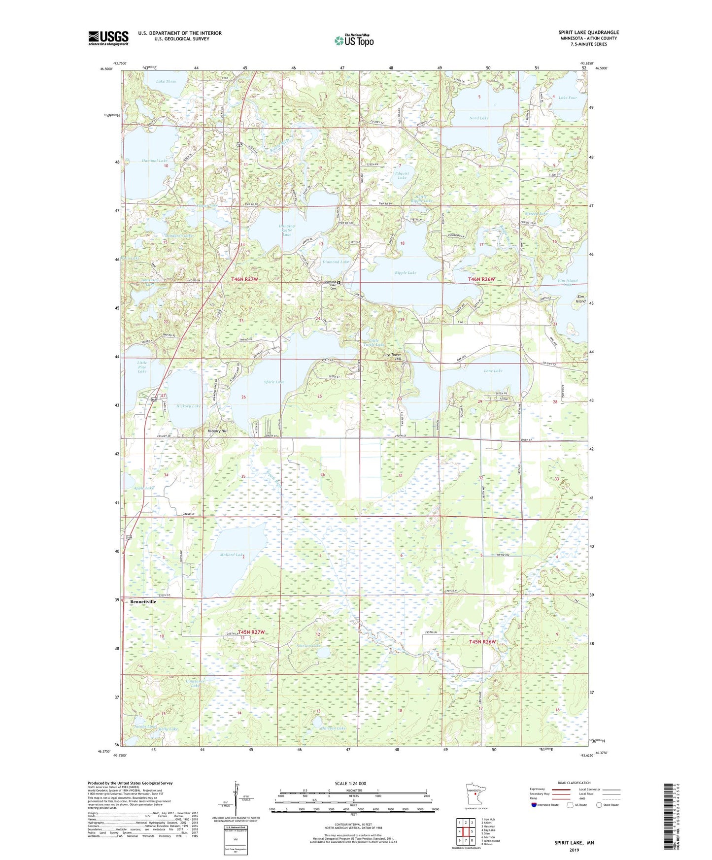
2019 topographic map quadrangle Spirit Lake in the state of Minnesota. Scale: 1:24000. Based on the newly updated USGS 7.5' US Topo map series, this map is in the following counties: Aitkin. The map contains contour data, water features, and other items you are used to seeing on USGS maps, but also has updated roads and other features. This is the next generation of topographic maps. Printed on high-quality waterproof paper with UV fade-resistant inks.
Quads adjacent to this one:
West: Bay Lake
Northwest: Iron Hub
North: Aitkin
Northeast: Hassman
East: Glen
Southeast: Malmo
South: Wealthwood
Southwest: Garrison
Contains the following named places: Anderson Lake, Apple Lake, Bachelor Lake, Bennettville, Big K Campground, Constance Lake, Diamond Lake, Diamond Lake Cemetery, Ditch Number Thirtyfour, Edquist Lake, Elm Island, Elm Island Lake, Fire Tower Hill, Hammal Lake, Hanging Kettle Lake, Hanging Kettle Lake Dam, Hickory Hill, Hickory Lake, Jacobs Lake, Johnson Lake, Kelly Lake, Lake Four, Lake Three, Landgren Lake, Little Pine Lake, Little Ripple Lake, Little Turtle Lake, Lone Lake, Mallard Lake, Maria Chapel, Nord Lake, Pine Lake, Pine Lake Dam, Ripple Lake, Ripple Lake Dam, Ripple River State Wildlife Management Area, Sixteen Lake, Spirit Lake, Sunset Lake, Thirteen Lake, Township of Farm Island, ZIP Code: 56431