MyTopo
Garrison Minnesota US Topo Map
Couldn't load pickup availability
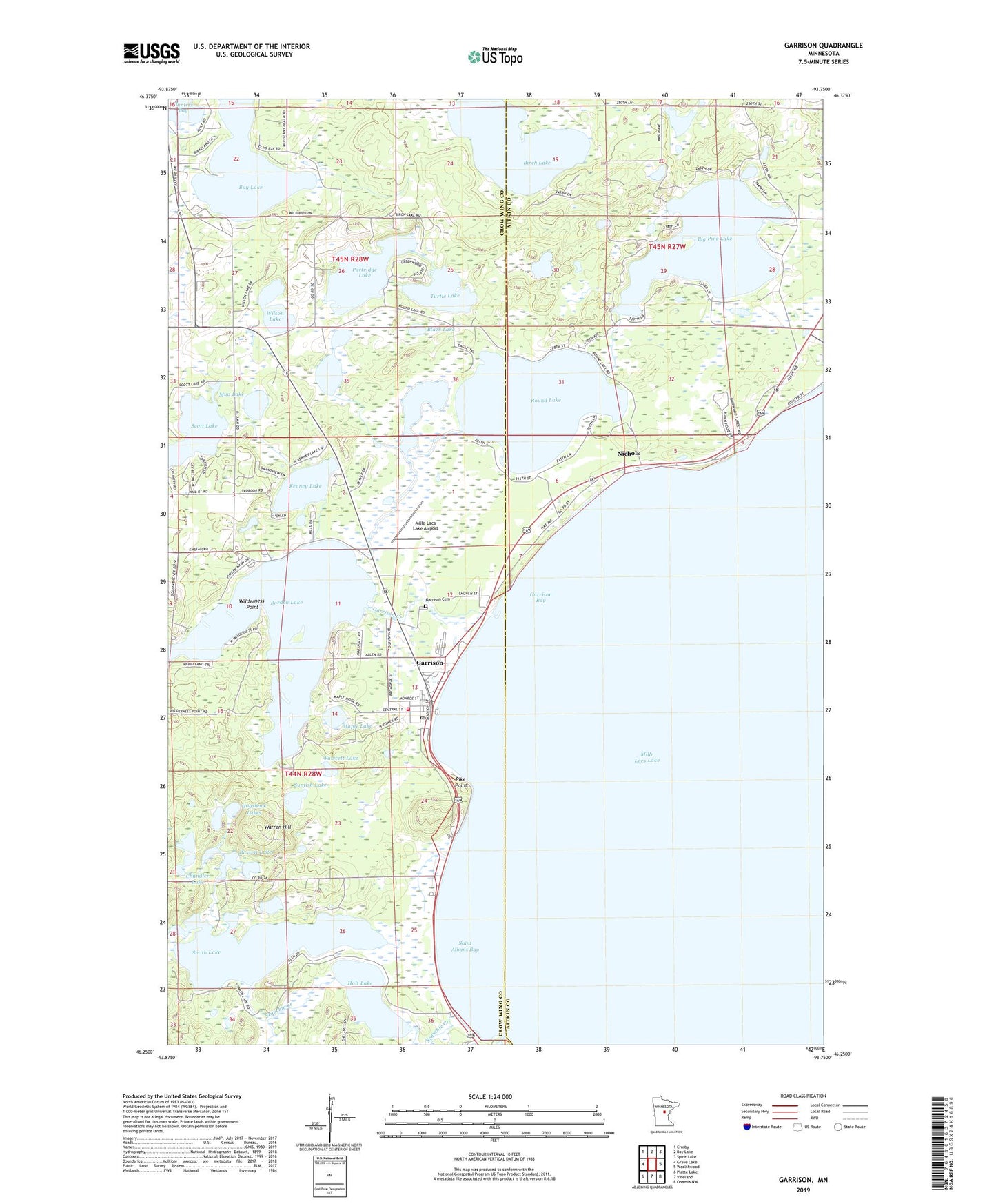
2022 topographic map quadrangle Garrison in the state of Minnesota. Scale: 1:24000. Based on the newly updated USGS 7.5' US Topo map series, this map is in the following counties: Crow Wing, Aitkin. The map contains contour data, water features, and other items you are used to seeing on USGS maps, but also has updated roads and other features. This is the next generation of topographic maps. Printed on high-quality waterproof paper with UV fade-resistant inks.
Quads adjacent to this one:
West: Grave Lake
Northwest: Crosby
North: Bay Lake
Northeast: Spirit Lake
East: Wealthwood
Southeast: Onamia NW
South: Vineland
Southwest: Platte Lake
This map covers the same area as the classic USGS quad with code o46093c7.
Contains the following named places: Bassett Lakes, Big Pine Lake, Birch Lake, Black Lake, Bob's Trailer Park, Borden Lake, Borden Lake Dam, Borden Lake Lookout Tower, Camp Jacobsen, Chandler Lake, City of Garrison, Community Alliance Church, Cutler, Fawcett Lake, Garrison, Garrison Bay, Garrison Cemetery, Garrison Concourse Wayside Park, Garrison Creek, Garrison Fire and Rescue Department, Garrison Golf Course, Garrison Post Office, Garrison Rest Area, Garrison Trailer Park, Geology of the Lake Mille Lacs Geological Marker, Hogsback Lakes, Holt Lake, Holt Lake Dam, Hunters Bay, Kenney Lake, Kenney Lake Overlook, Light of the Cross Lutheran Church, Maple Lake, Mille Lacs Lake Airport, Mud Lake, Nichols, Nichols Post Office, Our Lady of Fatima Church, Partridge Lake, Pike Point, Pine Lake Chapel, Rosackers Number 2 Seaplane Base, Round Lake, Saint Albans Bay, Scott Lake, Sequchie Creek, Shepherd of the Lake Lutheran Church, Smith Lake, Sunfish Lake, Township of Bay Lake, Township of Garrison, Turtle Lake, Warren Hill, Wilderness Point, Wilson Lake