MyTopo
Stacy Minnesota US Topo Map
Couldn't load pickup availability
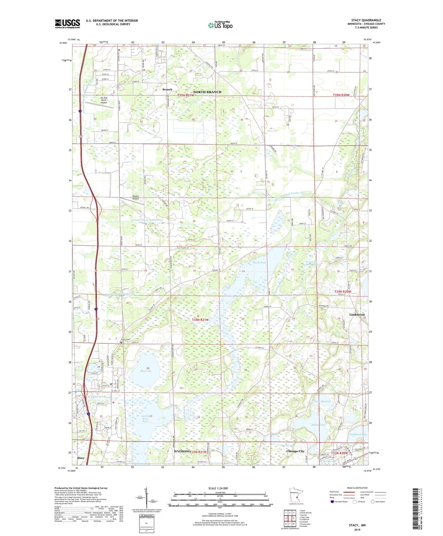
2022 topographic map quadrangle Stacy in the state of Minnesota. Scale: 1:24000. Based on the newly updated USGS 7.5' US Topo map series, this map is in the following counties: Chisago. The map contains contour data, water features, and other items you are used to seeing on USGS maps, but also has updated roads and other features. This is the next generation of topographic maps. Printed on high-quality waterproof paper with UV fade-resistant inks.
Quads adjacent to this one:
West: Typo Lake
Northwest: Stark
North: North Branch
Northeast: Sunrise
East: Lindstrom
Southeast: Scandia
South: Forest Lake
Southwest: Linwood
This map covers the same area as the classic USGS quad with code o45092d8.
Contains the following named places: Al's Due North Airport, Bowers Airport, Branch, City of Stacy, County Ditch Number Five, County Ditch Number Seven, County Ditch Number Ten, Faith Church, Falcon Ridge Golf Course, Lake Mattson, Mud Lake, North Branch Fire Department, North Pool, Peterson Slough, Saint John's Academy, Saint John's Lutheran Church, School Lake, Stacy, Stacy - Lent Fire Department, Stacy Cemetery, Stacy City Hall, Stacy City Park, Stacy Post Office, Sunrise Airport, Sunrise Elementary School, Sunrise Estates Mobile Home Park, Sunrise River Pool 1, Sunrise River Pool 1 Dam, Sunrise River Pool 3, Sunrise River Pool 3 Dam, Swamp Lake, Township of Lent, Trinity Bible Church, Wallmark Lake, West Branch Sunrise River