MyTopo
Scandia Minnesota US Topo Map
Couldn't load pickup availability
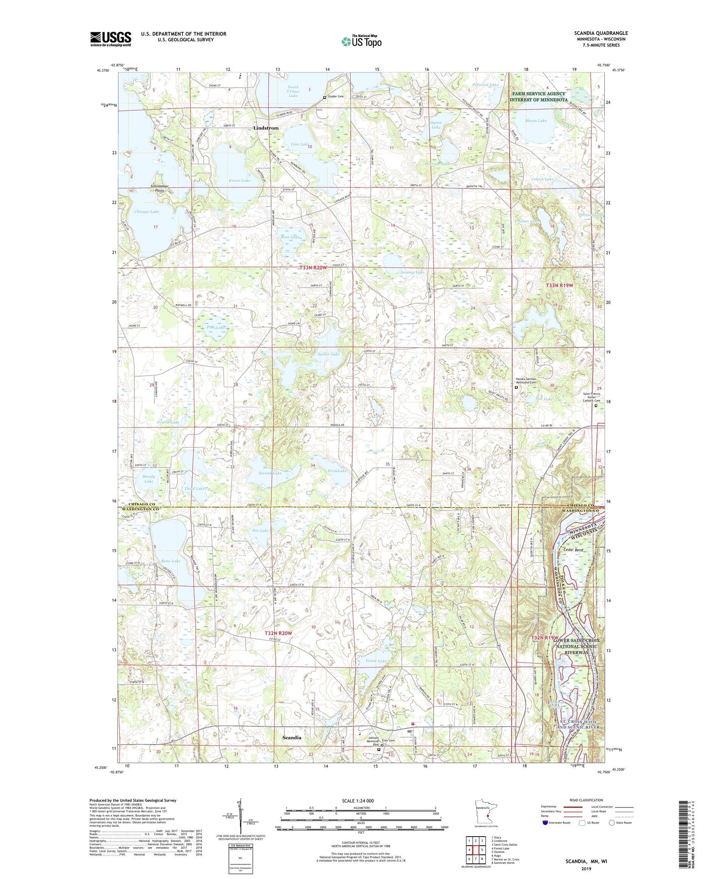
2022 topographic map quadrangle Scandia in the states of Minnesota, Wisconsin. Scale: 1:24000. Based on the newly updated USGS 7.5' US Topo map series, this map is in the following counties: Chisago, Washington, Polk. The map contains contour data, water features, and other items you are used to seeing on USGS maps, but also has updated roads and other features. This is the next generation of topographic maps. Printed on high-quality waterproof paper with UV fade-resistant inks.
Quads adjacent to this one:
West: Forest Lake
Northwest: Stacy
North: Lindstrom
Northeast: Saint Croix Dalles
East: Osceola
Southeast: Somerset North
Southwest: Hugo
Contains the following named places: Bloom Lake, Bone Lake, Boos Lake, Cedar Bend, Chisago Lake, Chisago Lakes Golf Club, Chisago Lakes High School, City of Lindstrom, City of Scandia, Coleen Lake, Duck Lake, Elim Cemetery, Farmington Bottoms State Natural Area, First Lake, Fourth Lake, Glader Cemetery, Goose Lake, Ice Lake, Johnson Memorial Park, Kroon Lake, Linn Lake, McLeods Slough, Moody Lake, Nielsen Lake, Ogren Lake, Panola German Methodist Cemetery, Pearson Lake, Peterson Lake, Pine Lake, Pleasant Valley Orchard, Rutstrum State Wildlife Management Area, Saint Francis Xavier Catholic Cemetery, Saint Francis Xavier Church, Scandia, Scandia Elementary School, Scandia Fire and Rescue Department, Scandia Post Office, Schlimmer Point, Sea Lake, Second Lake, Spider Lake, Swamp Lake, Third Lake, Township of Chisago Lake, Township of Franconia, Township of New Scandia, Trulson Lake, ZIP Code: 55073