MyTopo
Steele Center Minnesota US Topo Map
Couldn't load pickup availability
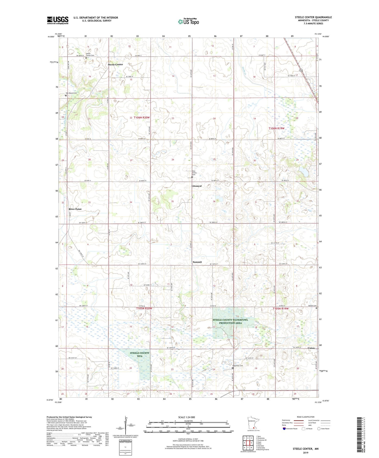
2019 topographic map quadrangle Steele Center in the state of Minnesota. Scale: 1:24000. Based on the newly updated USGS 7.5' US Topo map series, this map is in the following counties: Steele. The map contains contour data, water features, and other items you are used to seeing on USGS maps, but also has updated roads and other features. This is the next generation of topographic maps. Printed on high-quality waterproof paper with UV fade-resistant inks.
Quads adjacent to this one:
West: Hope
Northwest: Saco
North: Owatonna
Northeast: Owatonna SE
East: Bixby
Southeast: Blooming Prairie
South: Hollandale
Southwest: Ellendale
Contains the following named places: Aurora State Wildlife Management Area, Bohemian Cemetery, County Ditch Number Twentyone, County Ditch Number Twentyseven, Danish Cemetery, Donald Anderson Dam, Holy Trinity Catholic Church, Holy Trinity Cemetery, Litomysl, Litomysl Church, Myron Standke Dam, Oak Mound Cemetery, Pogones State Wildlife Management Area, River Point, Riverpoint Post Office, Saint Isodore School, School Number 2102, School Number 2112, School Number 2114, School Number 2127, School Number 2146, Steele Center, Steele Center Cemetery, Steele Center Post Office, Steele County Waterfowl Production Area, Summit, Township of Somerset, Township of Summit, Union