MyTopo
Stephen West Minnesota US Topo Map
Couldn't load pickup availability
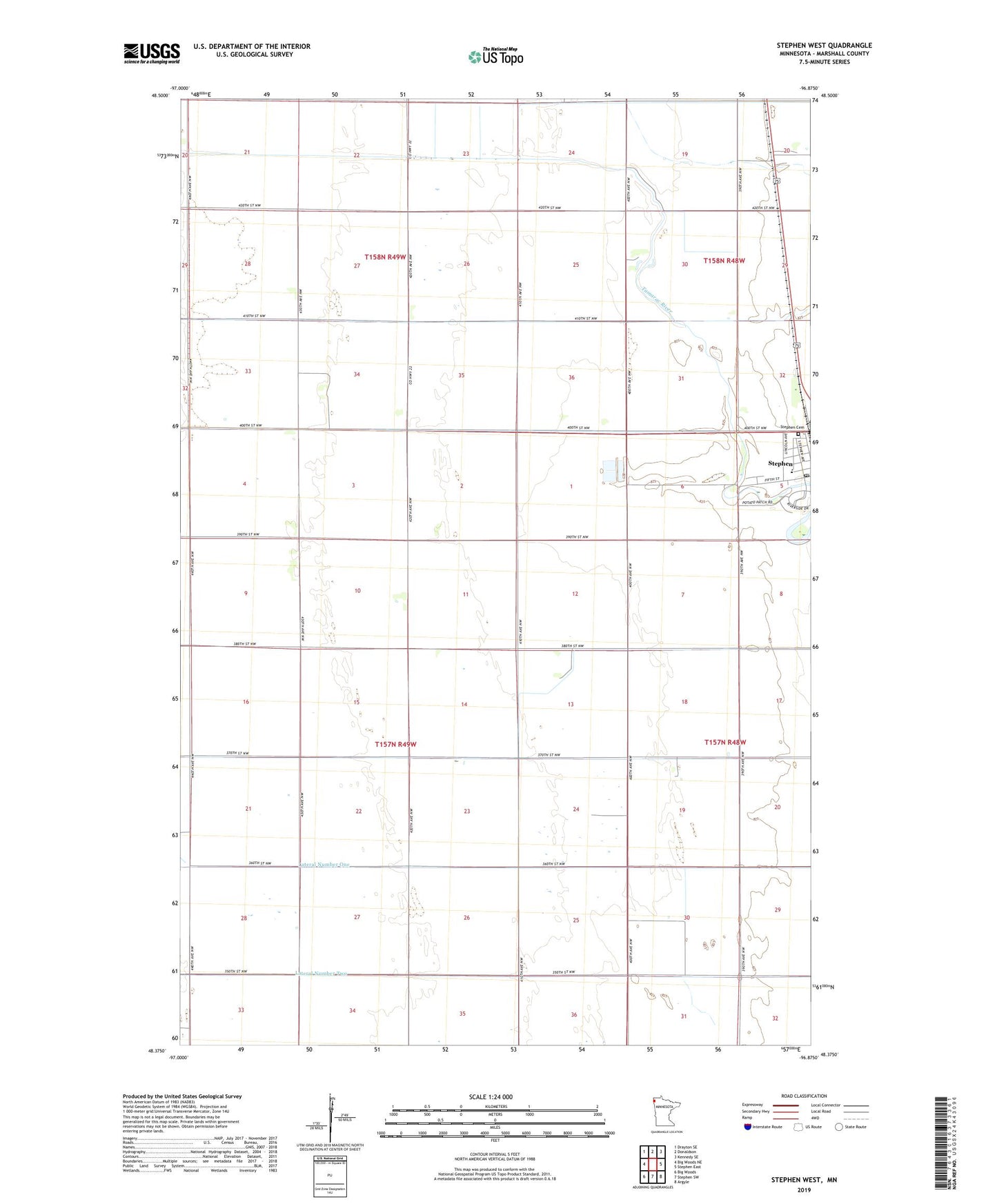
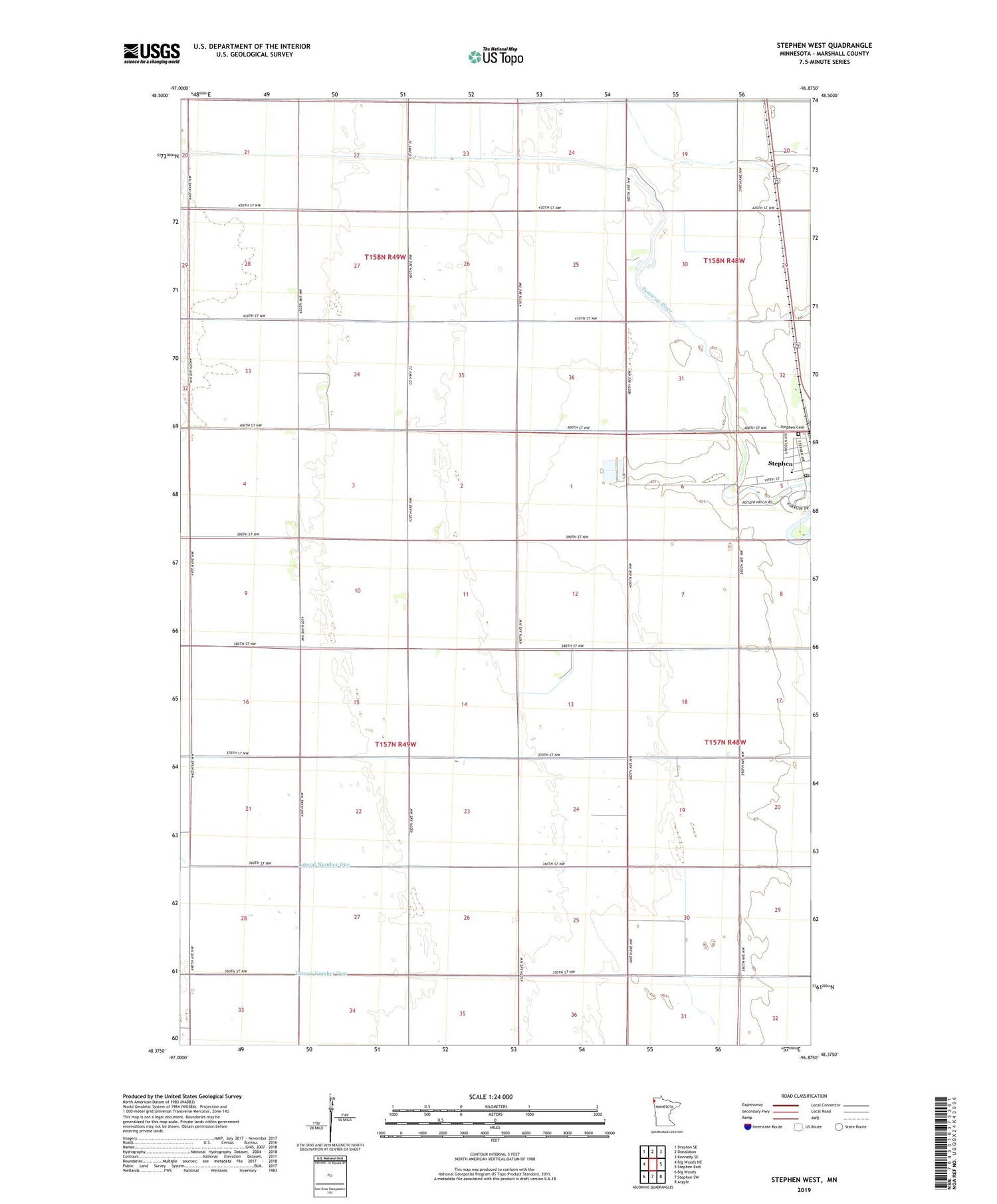
2019 topographic map quadrangle Stephen West in the state of Minnesota. Scale: 1:24000. Based on the newly updated USGS 7.5' US Topo map series, this map is in the following counties: Marshall. The map contains contour data, water features, and other items you are used to seeing on USGS maps, but also has updated roads and other features. This is the next generation of topographic maps. Printed on high-quality waterproof paper with UV fade-resistant inks.
Quads adjacent to this one:
Northwest: Drayton SE
North: Donaldson
Northeast: Kennedy SE
East: Stephen East
Southeast: Argyle
South: Stephen SW
Southwest: Big Woods
Contains the following named places: City of Stephen, County Ditch Number Eleven, First Lutheran Church, First Presbyterian Church, Lateral Number One, Lateral Number Two, Saint Stephen Church, School Number 54, School Number 70, Stephen Cemetery, Stephen Golf Course, Stephen Post Office, Stephen/Argyle Central School, Township of Parker, ZIP Code: 56757