MyTopo
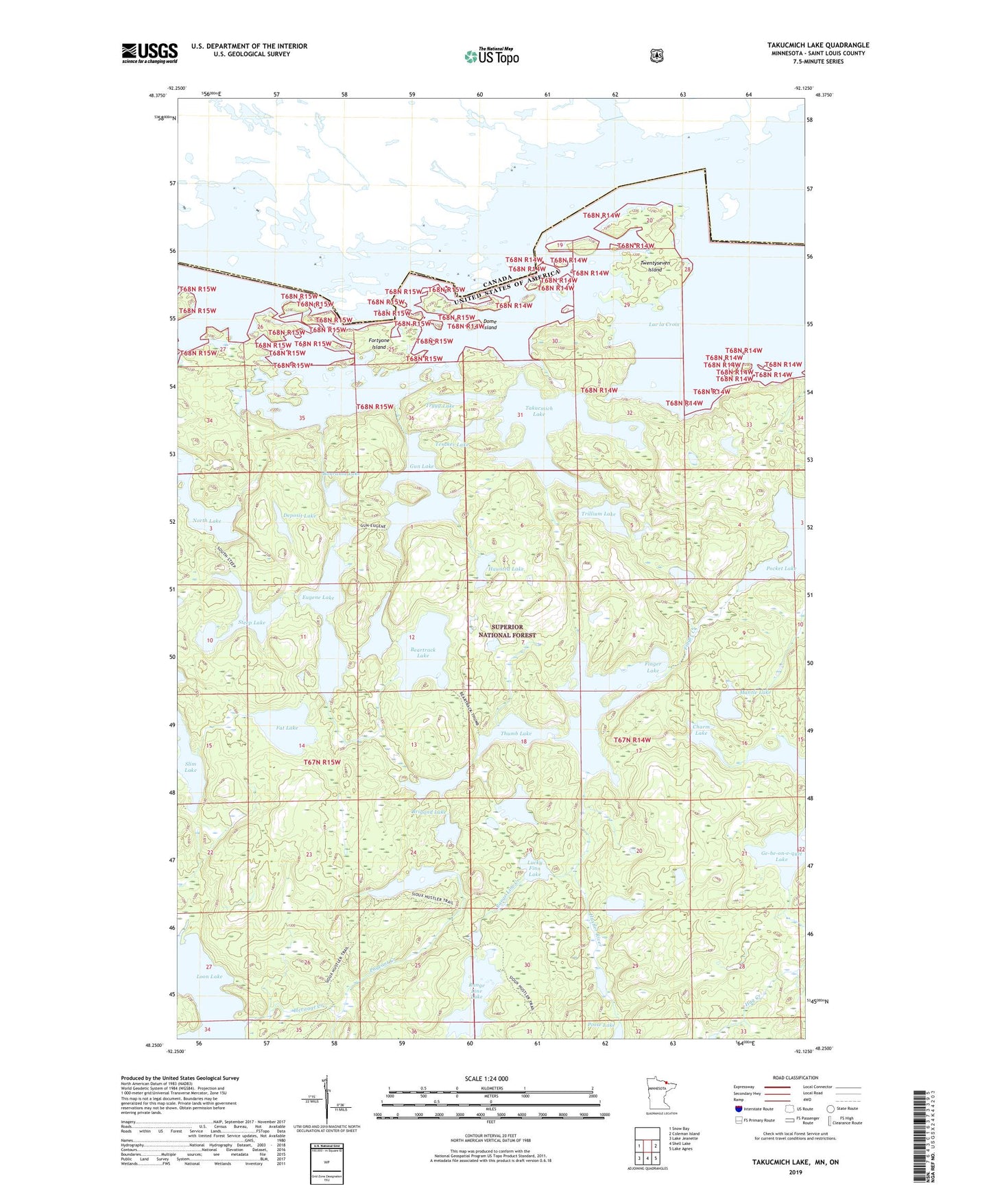
Takucmich Lake Minnesota US Topo Map
Couldn't load pickup availability
Also explore the Takucmich Lake Forest Service Topo of this same quad for updated USFS data
2022 topographic map quadrangle Takucmich Lake in the state of Minnesota. Scale: 1:24000. Based on the newly updated USGS 7.5' US Topo map series, this map is in the following counties: St. Louis. The map contains contour data, water features, and other items you are used to seeing on USGS maps, but also has updated roads and other features. This is the next generation of topographic maps. Printed on high-quality waterproof paper with UV fade-resistant inks.
Quads adjacent to this one:
West: Snow Bay
East: Coleman Island
Southeast: Lake Agnes
South: Shell Lake
Southwest: Lake Jeanette
This map covers the same area as the classic USGS quad with code o48092c2.
Contains the following named places: Beartrack Lake, Bourassa Lake, Brigand Lake, Charm Lake, Contentment Lake, Deposit Lake, Dome Island, East Loon Bay, Eugene Lake, Fat Lake, Finger Creek, Finger Lake, Fortyone Island, Gun Lake, Hag Creek, Haunted Lake, Heritage Creek, Hustler River, Little Beartrack Lake, Lucky Finn Lake, Mantle Lake, Nahimana Lake, North Lake, Pageant Creek, Pageant Lake, Pocket Lake, Posse Lake, Range Line Creek, Range Line Lake, Slim Lake, South Lake, Steep Lake, Takucmich Lake, Tesaker Lake, Thumb Lake, Trillium Lake, Trygg Lake, Twentyseven Island