MyTopo
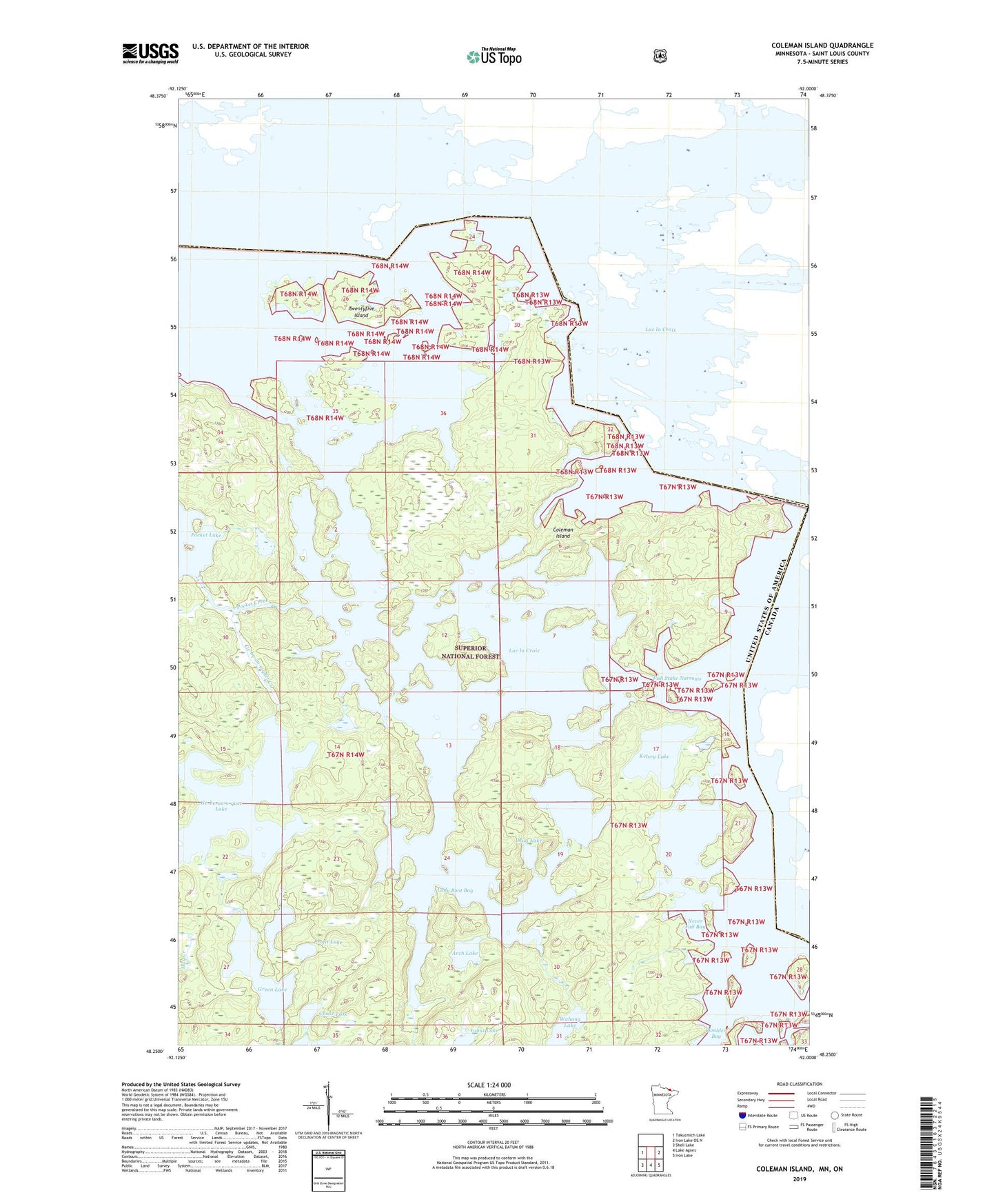
Coleman Island Minnesota US Topo Map
Couldn't load pickup availability
Also explore the Coleman Island Forest Service Topo of this same quad for updated USFS data
2022 topographic map quadrangle Coleman Island in the state of Minnesota. Scale: 1:24000. Based on the newly updated USGS 7.5' US Topo map series, this map is in the following counties: St. Louis. The map contains contour data, water features, and other items you are used to seeing on USGS maps, but also has updated roads and other features. This is the next generation of topographic maps. Printed on high-quality waterproof paper with UV fade-resistant inks.
Quads adjacent to this one:
West: Takucmich Lake
East: Iron Lake OE N
Southeast: Iron Lake
South: Lake Agnes
Southwest: Shell Lake
This map covers the same area as the classic USGS quad with code o48092c1.
Contains the following named places: Arch Lake, Chase Lake, Coleman Island, Fish Stake Narrows, Ge-be-on-e-quet Creek, Ge-be-on-e-quet Lake, Green Lake, Kelsey Lake, Lac la Croix, Lady Boot Bay, Mug Lake, Never Fail Bay, Pekan Lake, Pocket Creek, Profit Lake, Toe Lake, Twentyfive Island, Wabang Lake, Yabut Lake