MyTopo
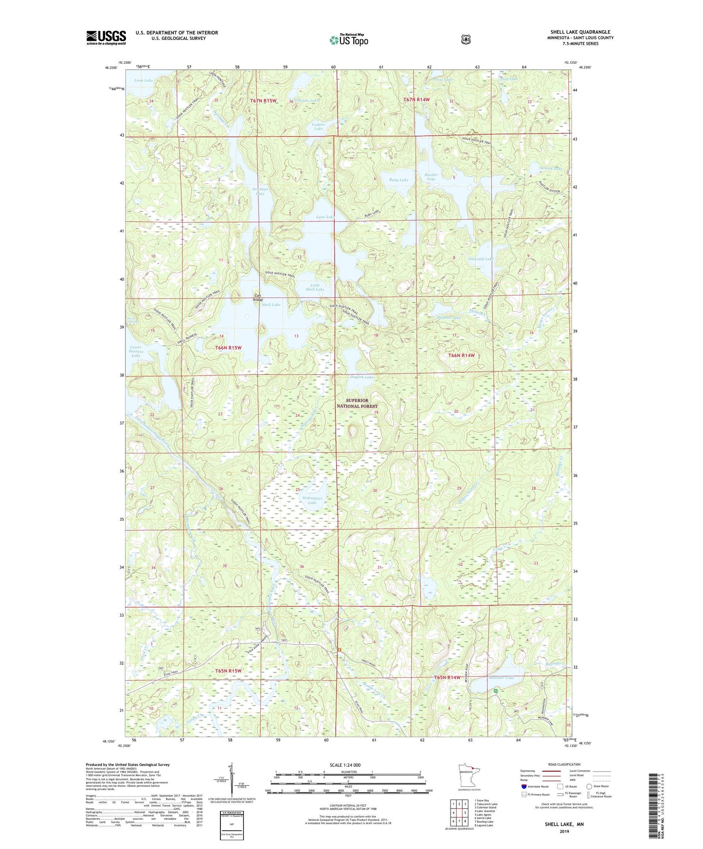
Shell Lake Minnesota US Topo Map
Couldn't load pickup availability
Also explore the Shell Lake Forest Service Topo of this same quad for updated USFS data
2022 topographic map quadrangle Shell Lake in the state of Minnesota. Scale: 1:24000. Based on the newly updated USGS 7.5' US Topo map series, this map is in the following counties: St. Louis. The map contains contour data, water features, and other items you are used to seeing on USGS maps, but also has updated roads and other features. This is the next generation of topographic maps. Printed on high-quality waterproof paper with UV fade-resistant inks.
Quads adjacent to this one:
West: Lake Jeanette
Northwest: Snow Bay
North: Takucmich Lake
Northeast: Coleman Island
East: Lake Agnes
Southeast: Lapond Lake
South: Bootleg Lake
Southwest: Astrid Lake
This map covers the same area as the classic USGS quad with code o48092b2.
Contains the following named places: Achundo Lake, Agawato Lake, Carol Creek, Clora Creek, Cold Springs Camp, Con Island, Dogfish Lake, Emerald Lake, Hag Lake, Heritage Lake, Hustler Lake, Jeanette Creek, Limpy Creek, Little Shell Lake, Lower Pauness Lake, Lynx Lake, Meander Creek, Meander Lake, Meander Lake Picnic Area, Range Line Creek, Ruby Lake, Shell Lake, Shohola Creek, Shohola Lake, Sioux River Campground, Sioux River Lookout Tower, Warpaint Lake, Weeny Lake, Woksapiwi Creek, Woksapiwi Lake, Yodeler Lake, ZIP Code: 55725