MyTopo
Underwood Minnesota US Topo Map
Couldn't load pickup availability
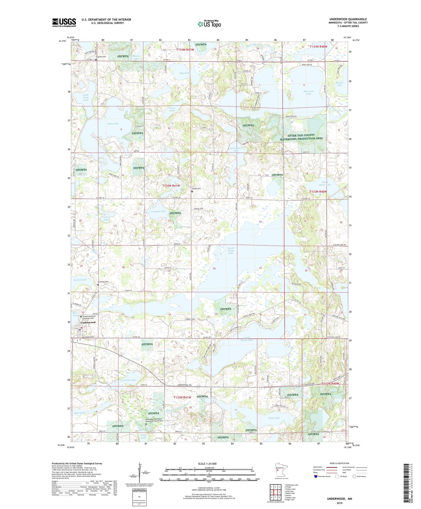
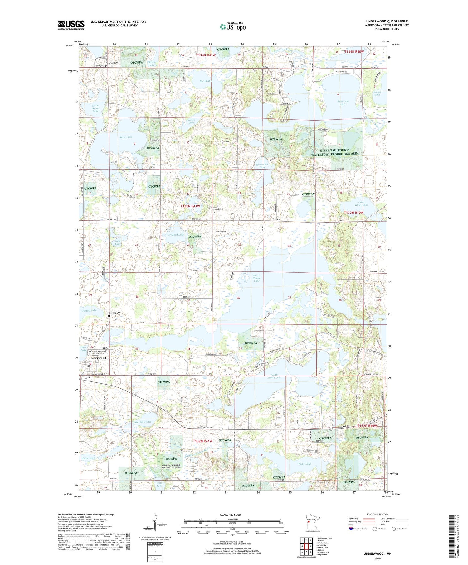
2019 topographic map quadrangle Underwood in the state of Minnesota. Scale: 1:24000. Based on the newly updated USGS 7.5' US Topo map series, this map is in the following counties: Otter Tail. The map contains contour data, water features, and other items you are used to seeing on USGS maps, but also has updated roads and other features. This is the next generation of topographic maps. Printed on high-quality waterproof paper with UV fade-resistant inks.
Quads adjacent to this one:
West: Wall Lake
Northwest: Heilberger Lake
North: Phelps
Northeast: Walker Lake
East: Battle Lake
Southeast: Eagle Lake
South: Stalker Lake
Southwest: Dalton
Contains the following named places: Anna Lake, Barnhard School, City of Underwood, Crooked Lake, Dane Lake, Deer Lake, East Lost Lake, Fiske Lake, Foss Log Cabin, German Lake, Horseshoe Lake, John Lake, Jones Lake, Larson Lake, Little Anna Lake, Messiah Lutheran Church, Mud Lake, North Turtle Lake, Norwegian Methodist Episcopal Church Cemetery, Onstad Lake, Rindal Cemetery, School Number 109, School Number 112, School Number 146, School Number 162, School Number 231, School Number 257, School Number 270, South Turtle Lake, Sunset Memorial Unitarian Cemetery, Sverdrup Cemetery, Sverdrup Lutheran Church, Third Silver Lake, Tingvold Cemetery, Tingvold Church, Township of Sverdrup, Underwood, Underwood Fire Department, Underwood High School, Underwood Post Office, Unitarian Church of Underwood, ZIP Code: 56586