MyTopo
Stalker Lake Minnesota US Topo Map
Couldn't load pickup availability
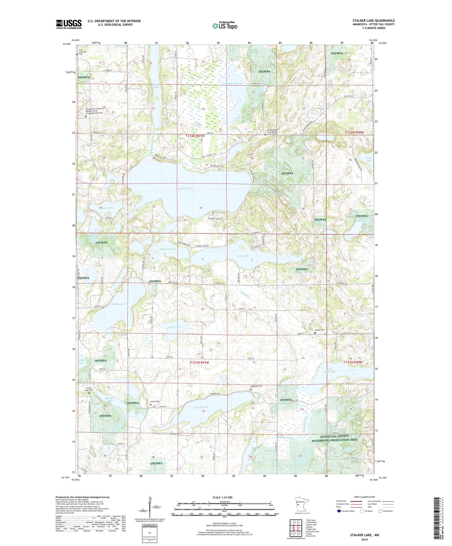
2022 topographic map quadrangle Stalker Lake in the state of Minnesota. Scale: 1:24000. Based on the newly updated USGS 7.5' US Topo map series, this map is in the following counties: Otter Tail. The map contains contour data, water features, and other items you are used to seeing on USGS maps, but also has updated roads and other features. This is the next generation of topographic maps. Printed on high-quality waterproof paper with UV fade-resistant inks.
Quads adjacent to this one:
West: Dalton
Northwest: Wall Lake
North: Underwood
Northeast: Battle Lake
East: Eagle Lake
Southeast: Evansville
South: Ashby
Southwest: Fourmile Lake
This map covers the same area as the classic USGS quad with code o46095b7.
Contains the following named places: Back Lake, Bethel Cemetery, Bethel Church, Blacken Lake, Evangelical Lutheran Rolling Prairie Congregational Cemetery, Free Lutheran Cemetery, Hanson Lake, Hollo Lake, Johannes Lake, Johnson Lake, Jolly Ann Lake, Kvam Cemetery, KVAM Church, Lacey Lake, Lakeside Cemetery, Lakeway Golf Course, Long Lake, Saint Olaf Cemetery, Saint Olaf Post Office, School Number 2, School Number 20, School Number 4, School Number 42, School Number 71, School Number 9, Sewell Lake, Stalker Lake, Stenerson Lake, Tamarack Lake, Tordenskjold Church, Tordenskjold Free Mission Church Cemetery, Township of Saint Olaf, Township of Tordenskjold, Whitman Lakebed