MyTopo
Dalton Minnesota US Topo Map
Couldn't load pickup availability
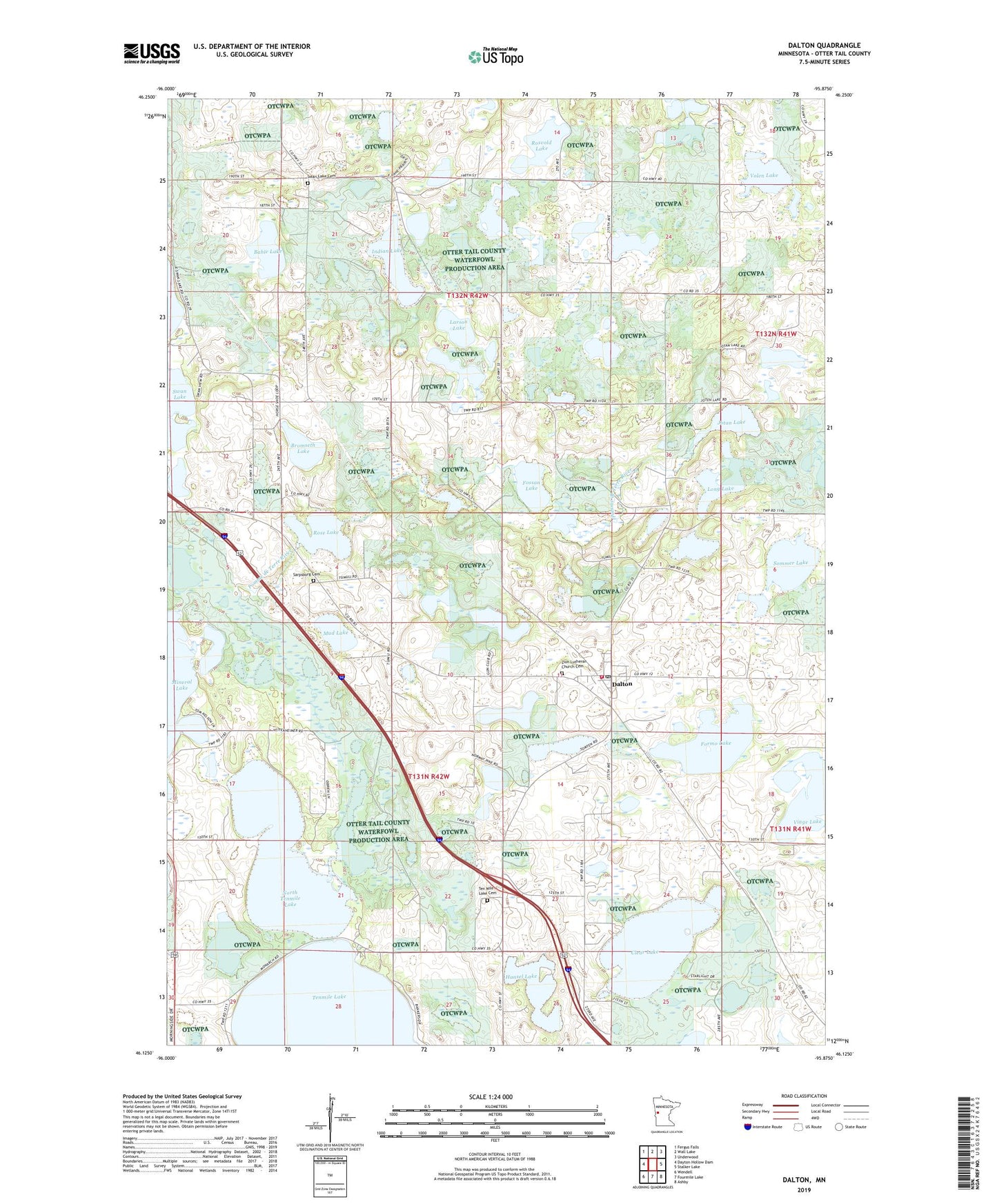
2022 topographic map quadrangle Dalton in the state of Minnesota. Scale: 1:24000. Based on the newly updated USGS 7.5' US Topo map series, this map is in the following counties: Otter Tail. The map contains contour data, water features, and other items you are used to seeing on USGS maps, but also has updated roads and other features. This is the next generation of topographic maps. Printed on high-quality waterproof paper with UV fade-resistant inks.
Quads adjacent to this one:
West: Dayton Hollow Dam
Northwest: Fergus Falls
North: Wall Lake
Northeast: Underwood
East: Stalker Lake
Southeast: Ashby
South: Fourmile Lake
Southwest: Wendell
This map covers the same area as the classic USGS quad with code o46095b8.
Contains the following named places: Bahle Lake, Bromseth Lake, Calvary Free Lutheran Church, City of Dalton, Clear Lake, Dalton, Dalton City Hall, Dalton Fire Department, Dalton Free Lutheran Church, Dalton Post Office, Dalton Trailer Court, Formo Lake, Fossan Lake, Hansel Lake, Hansel Lake Rest Area, Indian Lake, Jotan Lake, KJJK-AM (Fergus Falls), KJJK-FM (Fergus Falls), Larson Lake, Long Lake, Mud Lake, North Tenmile Lake, Our Saviour's Lutheran Church, Parkdale Post Office, Rose Lake, Rose Lake Dam, Rosvold Lake, Sarpsborg Cemetery, Sarpsborg Church, School Number 126, School Number 139, School Number 19, School Number 7, School Number 81, Sommer Lake, Steamboats on the Red River Historical Marker, Swan Lake Cemetery, Swan Lake Church, Swan Lake Lutheran Church Cemetery, Swan Lake Resort and Campground, Ten Mile Lake Cemetery, Tenmile Lake, Tenmile Lake Church, Tordenskjold Church, Tordenskjold Post Office, Township of Dane Prairie, Township of Tumuli, Vinge Lake, Volen Lake, Zion Lutheran Church Cemetery, Zion-Sarpsborg Free Lutheran Church, ZIP Code: 56324