MyTopo
Wabasso SE Minnesota US Topo Map
Couldn't load pickup availability
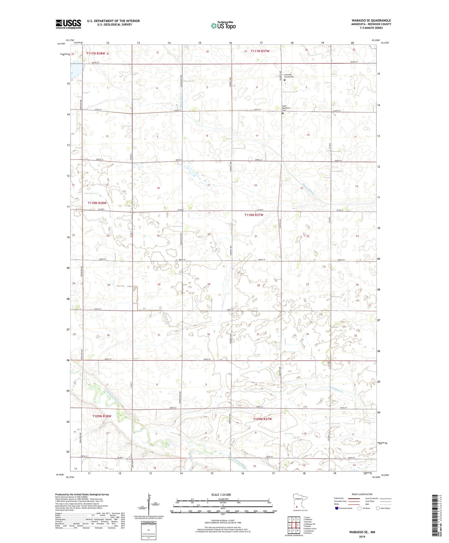
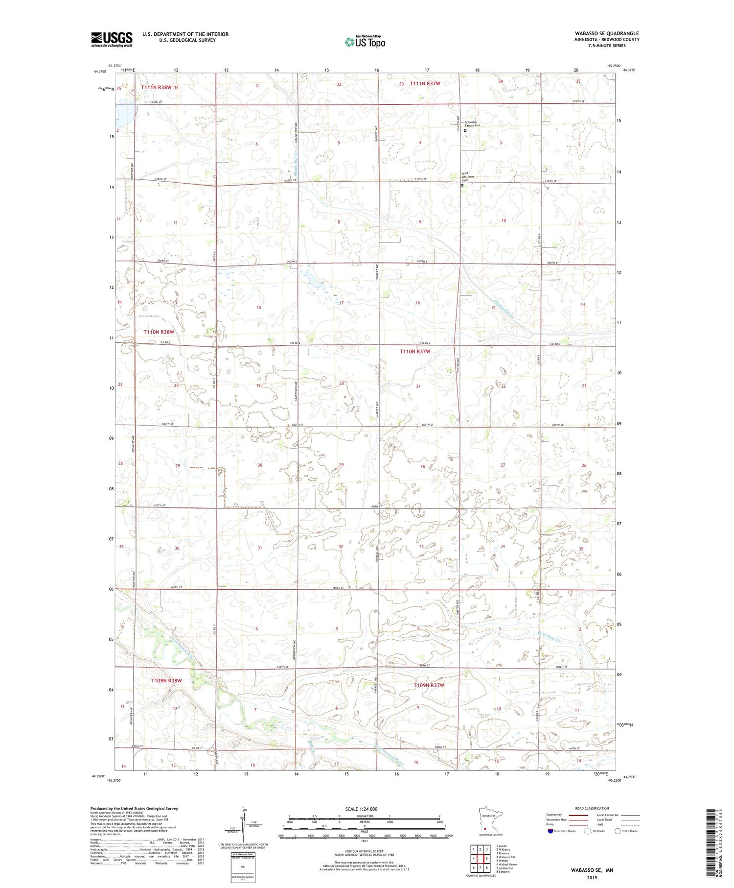
2019 topographic map quadrangle Wabasso SE in the state of Minnesota. Scale: 1:24000. Based on the newly updated USGS 7.5' US Topo map series, this map is in the following counties: Redwood. The map contains contour data, water features, and other items you are used to seeing on USGS maps, but also has updated roads and other features. This is the next generation of topographic maps. Printed on high-quality waterproof paper with UV fade-resistant inks.
Quads adjacent to this one:
West: Wabasso SW
Northwest: Lucan
North: Wabasso
Northeast: Rowena
East: Wanda
Southeast: Sanborn
South: Lamberton
Southwest: Walnut Grove
Contains the following named places: County Ditch Number Fiftyfour, Goblirsch Dairy, Judicial Ditch Number Thirtysix, Mammenga State Wildlife Management Area, Pell Creek, Saint Matthews Cemetery, Schwahn Family Plot, Township of Waterbury, Waterbury State Wildlife Management Area