MyTopo
Walnut Grove Minnesota US Topo Map
Couldn't load pickup availability
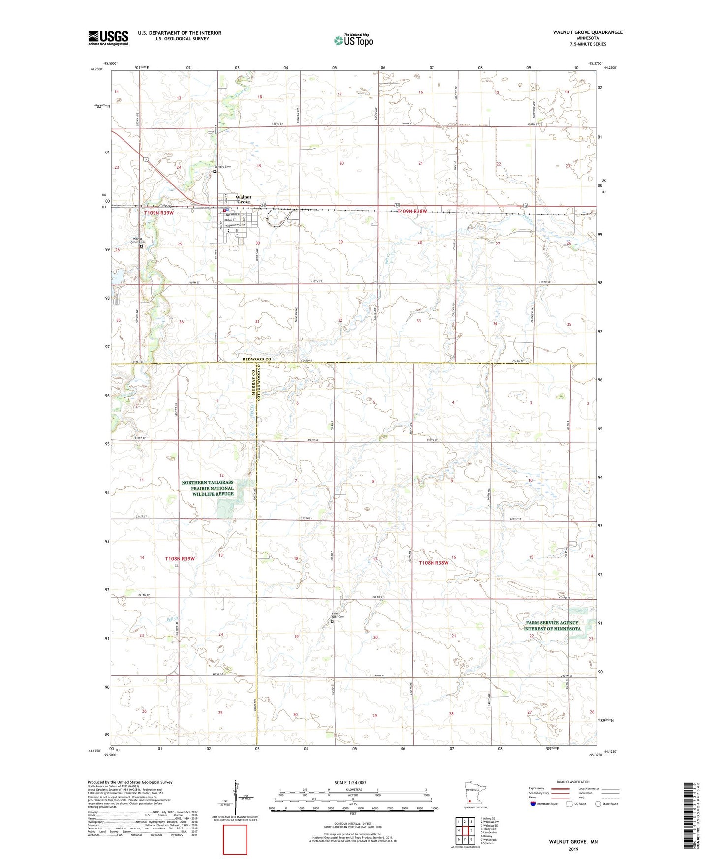
2022 topographic map quadrangle Walnut Grove in the state of Minnesota. Scale: 1:24000. Based on the newly updated USGS 7.5' US Topo map series, this map is in the following counties: Redwood, Cottonwood, Murray. The map contains contour data, water features, and other items you are used to seeing on USGS maps, but also has updated roads and other features. This is the next generation of topographic maps. Printed on high-quality waterproof paper with UV fade-resistant inks.
Quads adjacent to this one:
West: Tracy East
Northwest: Milroy SE
North: Wabasso SW
Northeast: Wabasso SE
East: Lamberton
Southeast: Storden
South: Westbrook
Southwest: Dovray
This map covers the same area as the classic USGS quad with code o44095b4.
Contains the following named places: Calvary Cemetery, City of Walnut Grove, County Ditch Number Twentyeight, English Lutheran Church, Heritage Baptist Bible Church, Methodist Church, Plum Creek Lake, Saint Olaf Cemetery, Saint Olaf Church, Saint Paul Parish, Township of Ann, Township of North Hero, Trinity Lutheran Church, Walnut Grove, Walnut Grove Cemetery, Walnut Grove City Hall, Walnut Grove Clinic, Walnut Grove Elementary School, Walnut Grove Fire Department, Walnut Grove Police Department, Walnut Grove Post Office, Walnut Grove Reservoir Dam, Wilder Museum, ZIP Codes: 56166, 56180