MyTopo
Lucan Minnesota US Topo Map
Couldn't load pickup availability
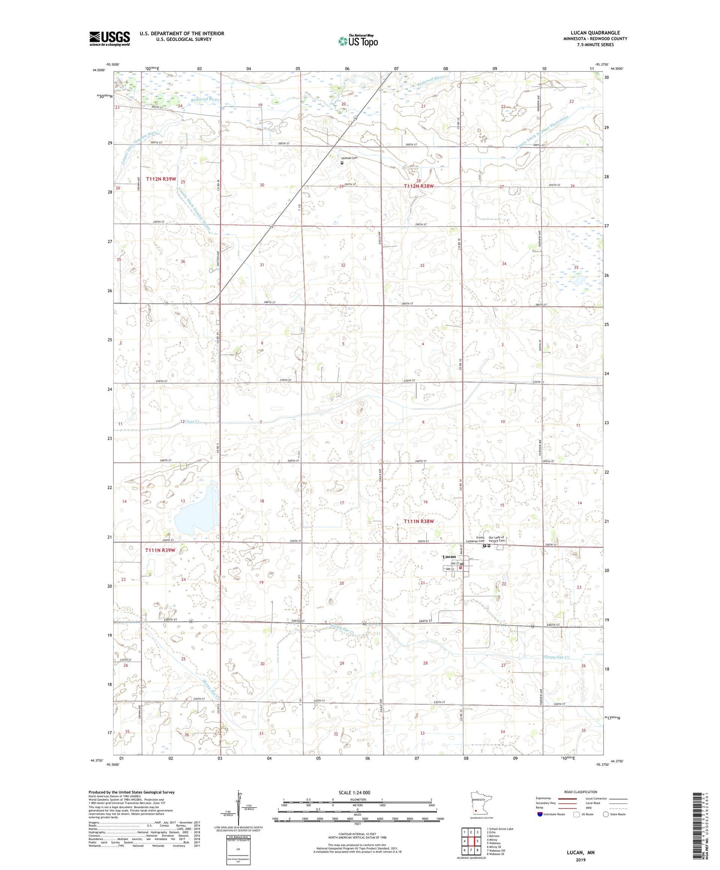
2022 topographic map quadrangle Lucan in the state of Minnesota. Scale: 1:24000. Based on the newly updated USGS 7.5' US Topo map series, this map is in the following counties: Redwood. The map contains contour data, water features, and other items you are used to seeing on USGS maps, but also has updated roads and other features. This is the next generation of topographic maps. Printed on high-quality waterproof paper with UV fade-resistant inks.
Quads adjacent to this one:
West: Milroy
Northwest: School Grove Lake
North: Echo
Northeast: Belview
East: Wabasso
Southeast: Wabasso SE
South: Wabasso SW
Southwest: Milroy SE
This map covers the same area as the classic USGS quad with code o44095d4.
Contains the following named places: City of Lucan, County Ditch Number Eighty, County Ditch Number Sixty, County Ditch Number Thirtythree, Hustad Cemetery, Kramer Farm, KRWF-TV (Redwood Falls), Lucan, Lucan Fire Department, Lucan Post Office, Lucan Town Hall, Lutheran Church, Our Lady of Victory Catholic Church, Our Lady of Victory Cemetery, Our Lady of Victory School, Rohlik State Wildlife Management Area, Township of Granite Rock, Township of Vesta, Trinity Lutheran Cemetery, Westline State Wildlife Management Area, ZIP Code: 56255