MyTopo
Warren SW Minnesota US Topo Map
Couldn't load pickup availability
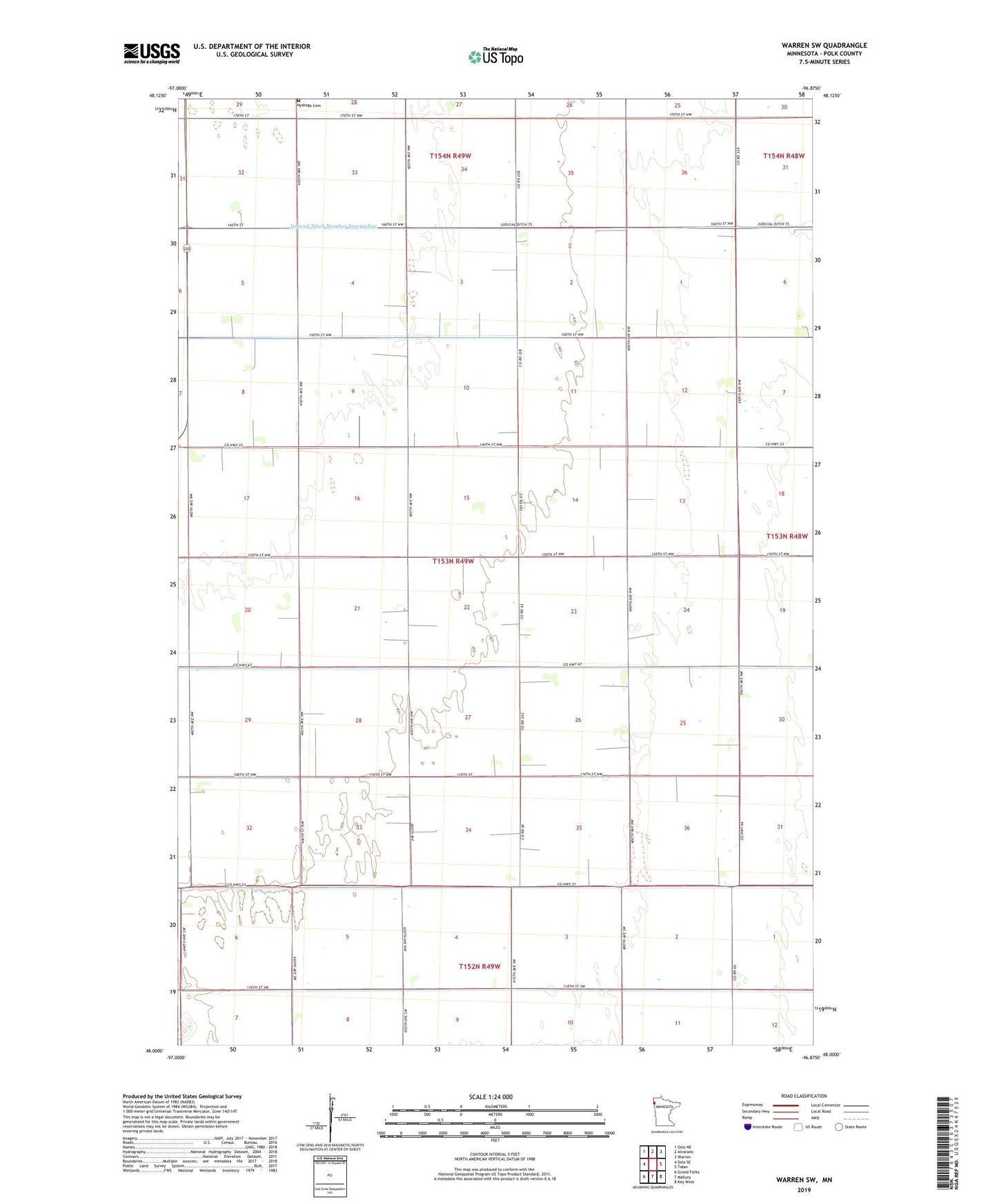
2022 topographic map quadrangle Warren SW in the state of Minnesota. Scale: 1:24000. Based on the newly updated USGS 7.5' US Topo map series, this map is in the following counties: Polk. The map contains contour data, water features, and other items you are used to seeing on USGS maps, but also has updated roads and other features. This is the next generation of topographic maps. Printed on high-quality waterproof paper with UV fade-resistant inks.
Quads adjacent to this one:
West: Oslo SE
Northwest: Oslo NE
North: Alvarado
Northeast: Warren
East: Tabor
Southeast: Key West
South: Mallory
Southwest: Grand Forks
This map covers the same area as the classic USGS quad with code o48096a8.
Contains the following named places: Ash Dale School, County Ditch Number Two, Judicial Ditch Number Seventyfive, Nyskoga Cemetery, Sunnyside School, Sunnyview School, Township of Northland