MyTopo
Warren Minnesota US Topo Map
Couldn't load pickup availability
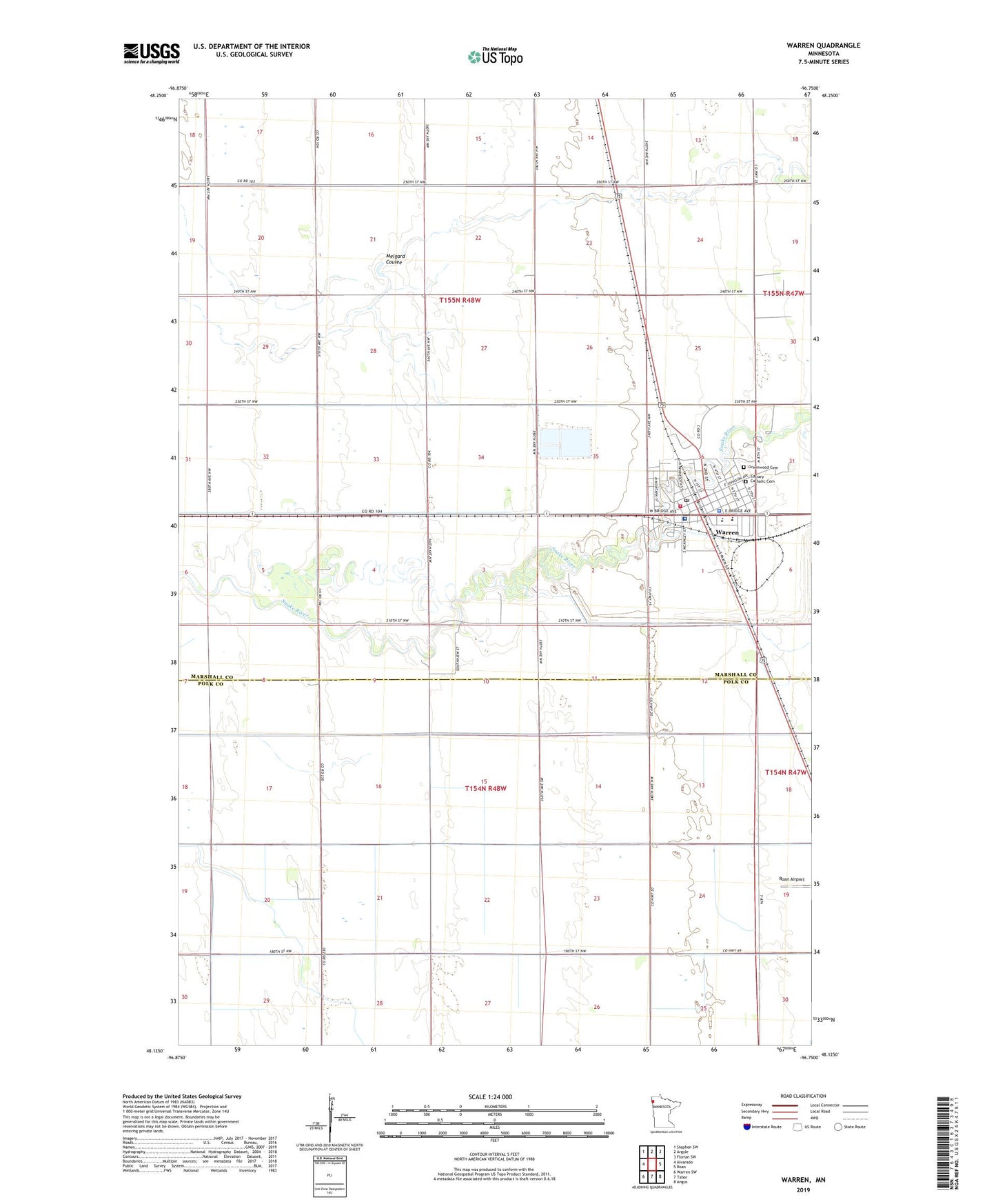
2022 topographic map quadrangle Warren in the state of Minnesota. Scale: 1:24000. Based on the newly updated USGS 7.5' US Topo map series, this map is in the following counties: Marshall, Polk. The map contains contour data, water features, and other items you are used to seeing on USGS maps, but also has updated roads and other features. This is the next generation of topographic maps. Printed on high-quality waterproof paper with UV fade-resistant inks.
Quads adjacent to this one:
West: Alvarado
Northwest: Stephen SW
North: Argyle
Northeast: Florian SW
East: Roan
Southeast: Angus
South: Tabor
Southwest: Warren SW
This map covers the same area as the classic USGS quad with code o48096b7.
Contains the following named places: Angus-Tabor Presbyterian Church, Assembly of God Church, Calvary Catholic Cemetery, City of Warren, County Ditch Number Fortytwo, County Ditch Number Four, County Ditch Number Seven, East Acres Mobile Home Park, Evangelical Covenant Church, First Lutheran Church, First Presbyterian Church, Good Samaritan Center, Grace United Methodist Church, Greenwood Cemetery, Honorville School, Judicial Ditch Number Seventeen, Marshall County Jail, Marshall County Sheriff's Office, Melgard Coulee, North Valley Health Center Hospital, Our Savior's Lutheran Church, Saints Peter and Paul Catholic Church, Sky-Vu Drive-In, Township of Boxville, Township of Farley, Township of Warrenton, Warren, Warren Junior-Senior High School, Warren Police Department, Warren Post Office, Warren Public Library, Warren Riverside Golf Course, Warren Station, Warren Volunteer Ambulance Service, Warren Volunteer Fire Department